


Meteorologist Kristy Steward's First Warning Forecast
Happy Thursday evening! A couple systems are heading our way, bringing us the chance for severe thunderstorms this evening into tonight. Then, we’ll move into a quieter, drier, and warmer stretch.
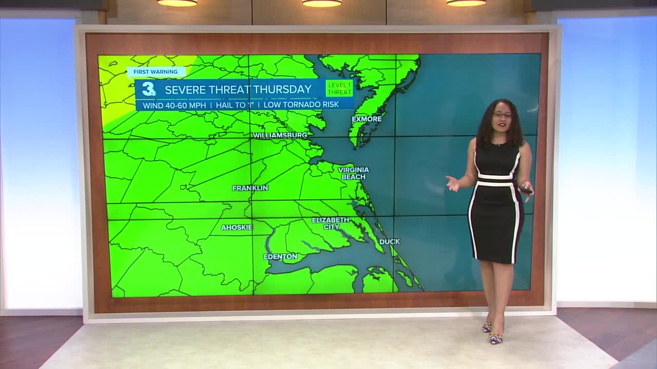
Everyone is still under a Level 1 of 5 risk for severe storms this evening into tonight. Damaging winds are the primary threat, but a spin-up tornado can’t be ruled out. This isn’t a big round of storms, but more isolated cells within scattered rain. The time to be aware is 8 PM - 12 AM.

Outside of storms, it will be windy. 15-25 MPH sustained winds with 35-45 MPH gusts. A Wind Advisory is in effect for the Eastern Shore and Outer Banks until 4 AM Friday. 25-30 MPH sustained winds gust to 50 MPH. Those strong winds will also create 7-9 feet breaking waves.

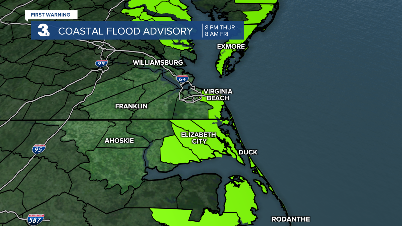
A Coastal Flood Advisory is in effect for the Eastern Shore, Virginia Beach, the Albemarle Sound and Outer Banks from 8 PM Thursday - 8 AM Friday. Around one foot of inundation is expected.
Friday will be mostly dry. Some spotty showers Friday morning and again in the evening, but a lot of the day will be dry. Winds will still be on the gusty side. High temperatures in the low 70s.
This weekend will be dry with plenty of sunshine. Winds will still be breezy. High temperatures will be a little cooler Saturday in the upper 60s, then rise into the upper 70s Sunday.
Next week, the dry stretch continues. Temperatures continue to rise and reach the low 80s for the workweek.
Connect with Meteorologist Kristy Steward:
FACEBOOK
X
INSTAGRAM
