


Meteorologist April Loveland's First Warning Forecast
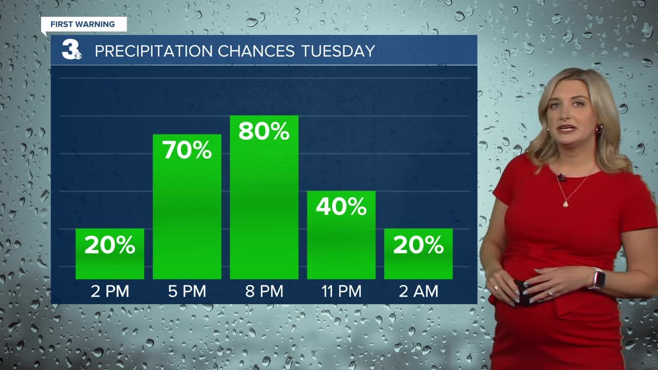
Today is the last day of summer-like warmth. We're tracking a cold front that will move in and bring us storms later this evening. Strong-to-severe storms will be possible. The biggest threat will be damaging wind gusts and heavy rain.


The best chance to see storms will be from 4 PM to 9 PM.

Once the cold front moves through, it will turn much cooler. Expect high temperatures to be 20 degrees cooler on Wednesday.
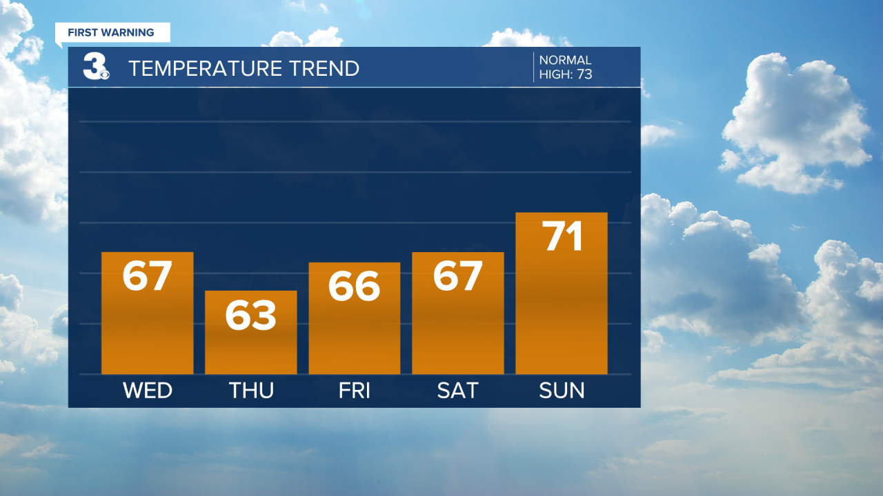
The normal high for this time of year is 73 degrees. Temperatures will trend below normal through Sunday. Highs on Wednesday will be in the mid 60s, then low 60s on Thursday. Sunshine will continue on Friday and Saturday with highs in the mid 60s. A bit warmer by Sunday with highs in the low 70s.
Rain chances will increase on Sunday and Monday. Highs will be in the low to mid 70s. Even warmer on Tuesday with highs near 80.
Meteorologist April Loveland
For weather updates on Facebook: HERE
Follow me on Twitter: HERE
Follow me on Instagram HERE
Check out the Interactive Radar on WTKR.com: Interactive Radar
