


Meteorologist April Loveland's First Warning Forecast
Just 3 days away from the First Day of Spring! Spring-like temperatures and showers will be the story for the rest of the week and into the weekend.

Partly cloudy today with highs in the mid 60s. Most of the daylight hours will be dry with showers and storms possible by tonight.
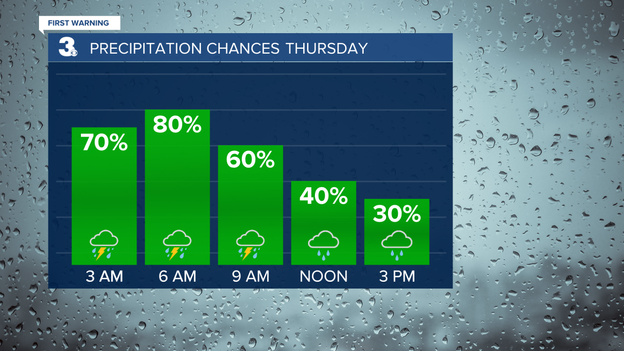
Showers and storms will continue overnight and into the first part of Thursday. Most of the area is under a level 1 for severe storms. The biggest threat will be damaging wind gusts and heavy rain. Localized flooding will be possible. Temperatures will be in the mid 60s. If you have St. Patrick's Day plans, just make them for a little later in the day.


Warming up just in time to end the work. Highs will soar to the low 70s. A few late-day showers will be possible.
Showers will continue into Saturday morning with highs in the mid 70s.
Looking dry for those of you running the Shamrock on Sunday. It's also the First Day of Spring. We'll see highs in the low 60s under partly cloudy skies.
Meteorologist April Loveland
For weather updates on Facebook: HERE
Follow me on Twitter: HERE
Follow me on Instagram HERE
Check out the Interactive Radar on WTKR.com: Interactive Radar
