


Meteorologist April Loveland's First Warning Forecast
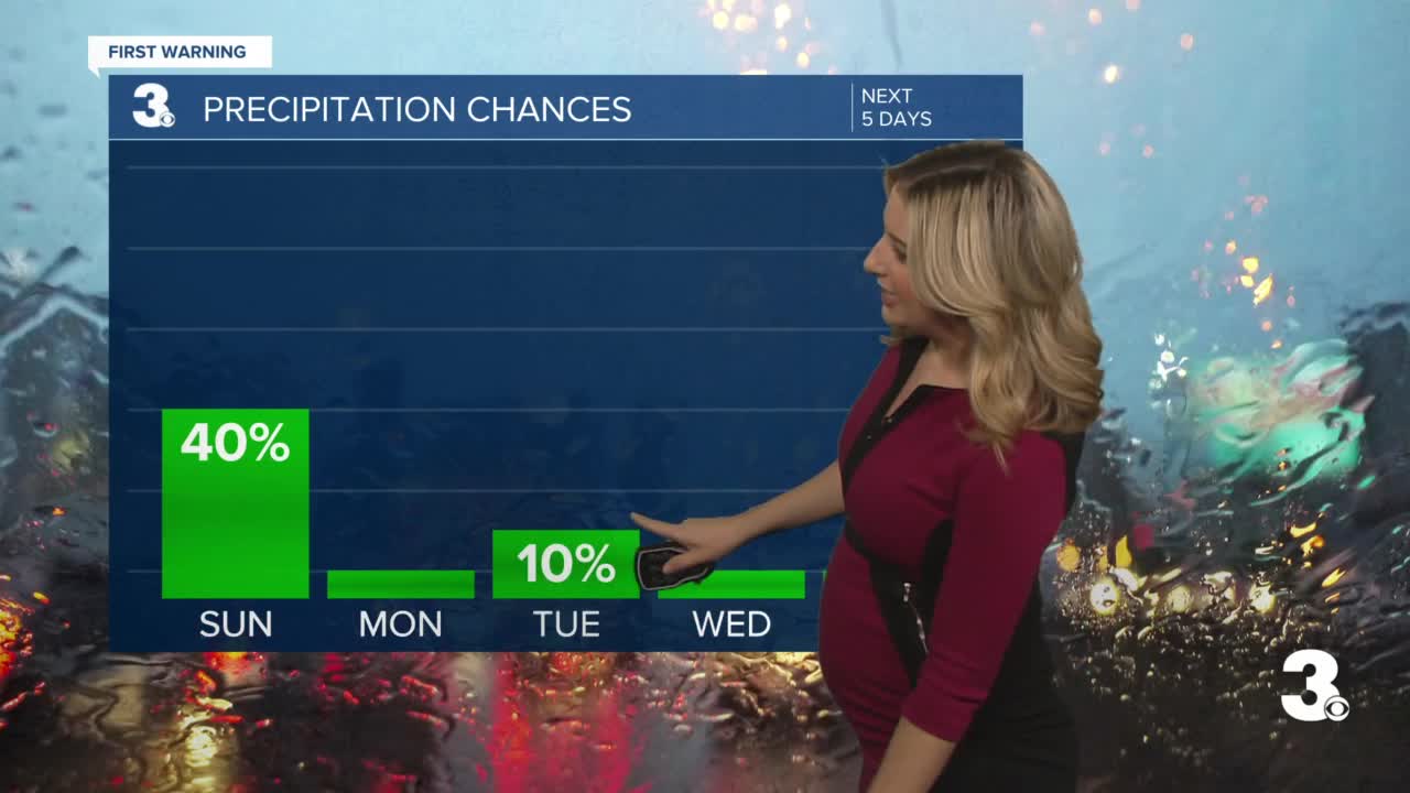
It's a cool and gloomy end to the weekend with showers. The first week of March is looking sunny and dry, but expect a few temperatures swings.

There's a chance for showers today as a weak area of low pressure moves in. The best chance will be across northeast North Carolina. A few showers could sneak in across the southside, otherwise expect overcast skies. Skies will start to clear later this evening. Temperatures will still be below normal for this time of year with highs in the upper 40s.
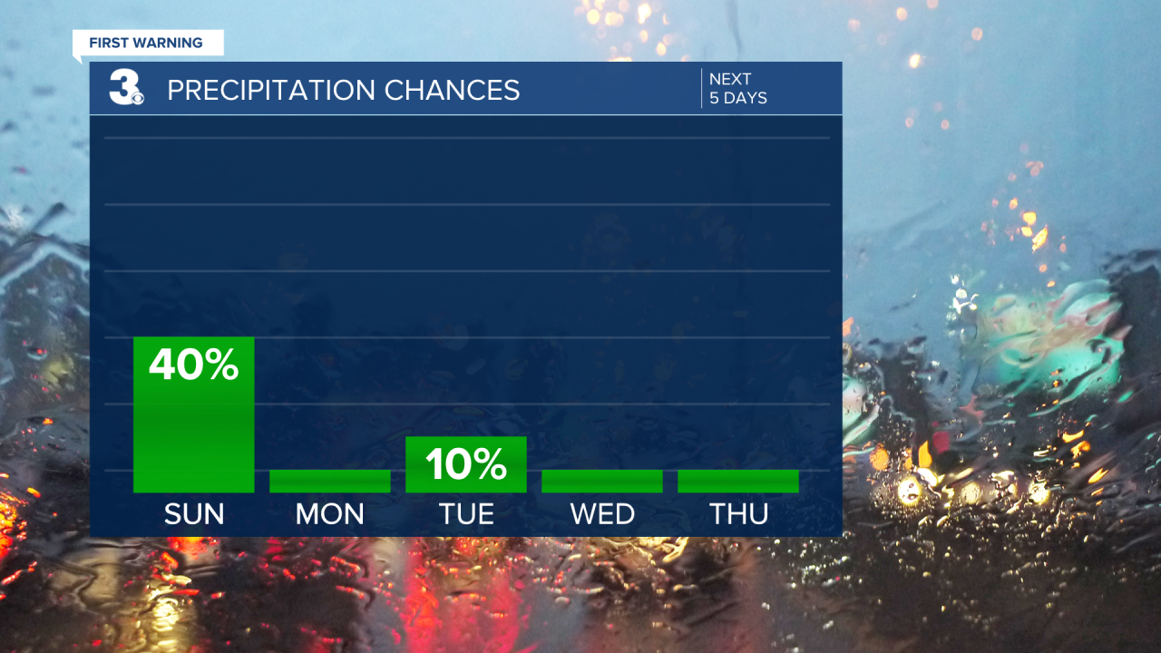
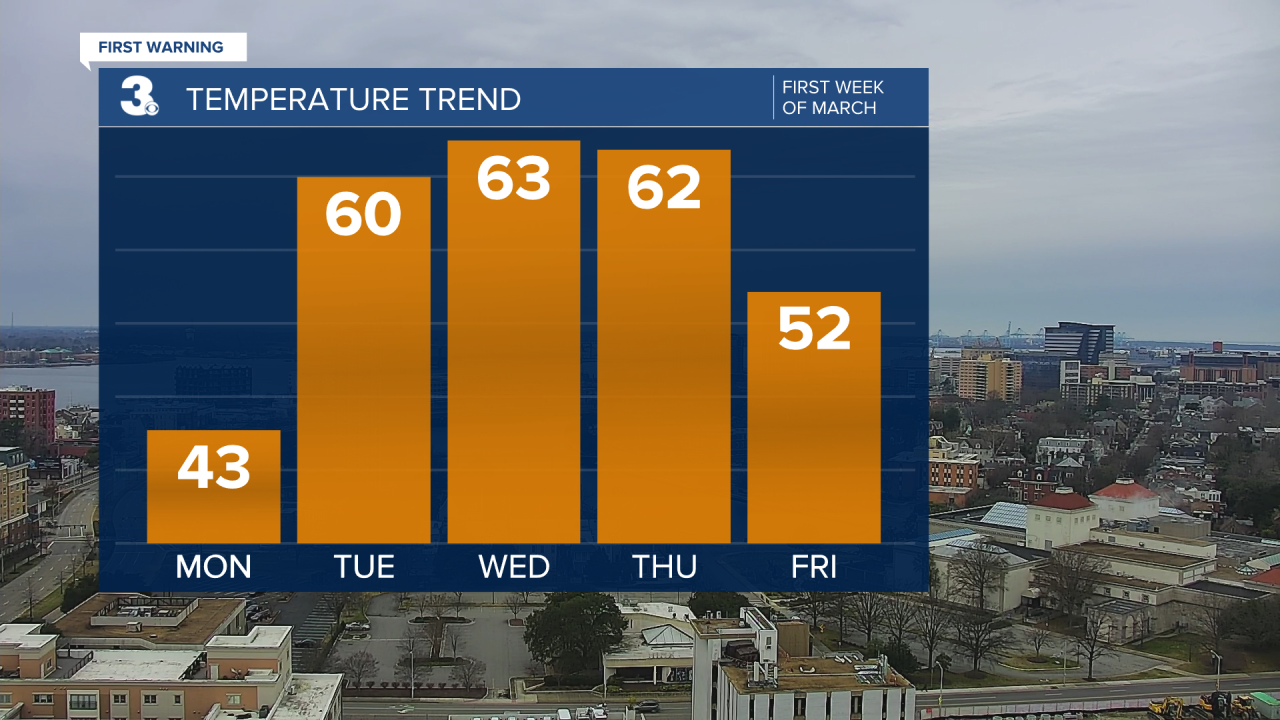
We say goodbye to February and hello to sunshine on Monday. Temperatures will once again take a tumble. Highs will only reach the low 40s.
A warm up is on tap for Tuesday and the first day of March. Expect a few more clouds with highs near the 60 degree mark. The picks of the week will be on Wednesday and Thursday as highs soar to the low 60s under mostly sunny skies.
Temperatures will cool a bit to end the work week, but it will still feature a nice mix of sun and clouds. Highs will be in the mid 50s.
Back to the 60s by the weekend.
Meteorologist April Loveland
For weather updates on Facebook: HERE
Follow me on Twitter: HERE
Follow me on Instagram HERE
Check out the Interactive Radar on WTKR.com: Interactive Radar
