


Meteorologist Kristy Steward's First Warning Forecast
Happy Monday night! The clouds today have been pesky, but we’ve been dry and temperatures were warmer. More sunshine and hotter temperatures will soon arrive.
Tonight, these pesky clouds clear out. Mild with lows around 70°.
There will be plenty of sunshine Tuesday with passing clouds moving in for the afternoon. Winds shift to southwesterly at 10-20 MPH. Those breezy southerly winds combined with sunshine helps temperatures soar into the low to mid 90s. Once you factor in the humidity, it will feel like we’re close to 100°. Stay cool and hydrated!
While most of us will stay dry Tuesday, the Peninsulas could see some showers in the evening. Showers to our north should dissipate just before they reach us, but a few may hold strong.
At least it’s a short-lived hot streak. Highs still in the low 90s Wednesday, but then a cold front will cool us down to the mid 80s Thursday into the weekend.
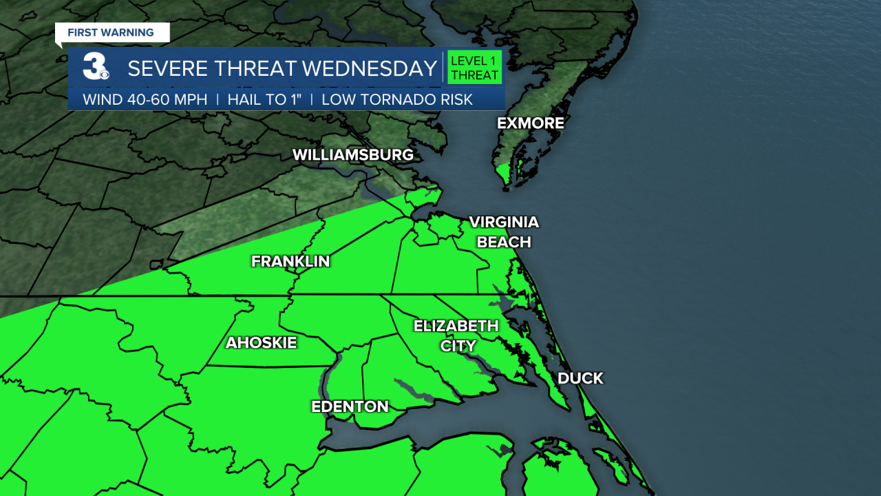
Around the cold front, expect scattered showers and storms Wednesday afternoon and evening. Some of those storms could become strong to severe. Most of the area is under a Level 1 of 5 risk for severe storms. Damaging winds will be the primary concern.
After the cold front passes through, it’ll stall across North Carolina. That will put us in a stormy pattern the rest of the week. Scattered storms Thursday and Friday. More isolated activity this weekend.
Connect with Meteorologist Kristy Steward:
FACEBOOK
TWITTER
INSTAGRAM
