


Meteorologist Kristy Steward's First Warning Forecast
Happy Easter! Today was cooler, but a beautiful holiday with lots of sunshine. That won't be the case Monday. A low pressure system across the Gulf States is heading our way and its center will pass through Hampton Roads Monday afternoon/evening.
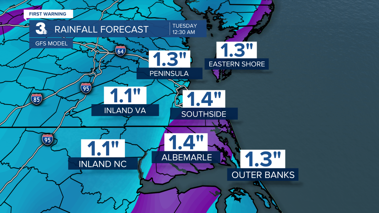
Ahead of this system, clouds quickly increase tonight and winds pick up. Expect east-northeasterly winds of 10-20 MPH overnight. Lows drop into the upper 40s. We stay dry tonight, but rain starts quickly moving in from the west-southwest Monday morning. Early commutes may be dry, but by 9 AM widespread rain really starts moving in. By lunchtime, widespread lighter rain starts to become moderate to heavy rain. The evening commute is looking rough. Heavy downpours, strong winds, and embedded thunderstorms. Plan to take it slow on the road getting home tomorrow. Some of those late afternoon/early evening storms could become strong to severe.
Level 1 out of 5 severe risk for mainland Dare county and the Outer Banks. The main threat will be damaging wind gusts. Heavy downpours could lead to localized minor flooding too. Outside of storms, expect 15-25 MPH east winds with gusts up to 40 MPH.

Around 10 PM, this widespread rain and storm activity should be to our northeast and clouds will quickly clear through Monday night. Behind the system, we stay windy Tuesday, but we'll be dry. Just a few passing clouds possible and maybe a stray sprinkle in our northern communities. High temperatures stay in the low 60s through Wednesday.
The rest of the week will be dry with plenty of sunshine. Thursday a warming trend begins. Highs in the low 70s reach the mid 70s Friday and soar into the low 80s by next Sunday.
Connect with Meteorologist Kristy Steward:
