


Saturday will stay warm, but a strong cold front is racing towards Hampton Roads that will bring us cold air and snow to end the weekend.
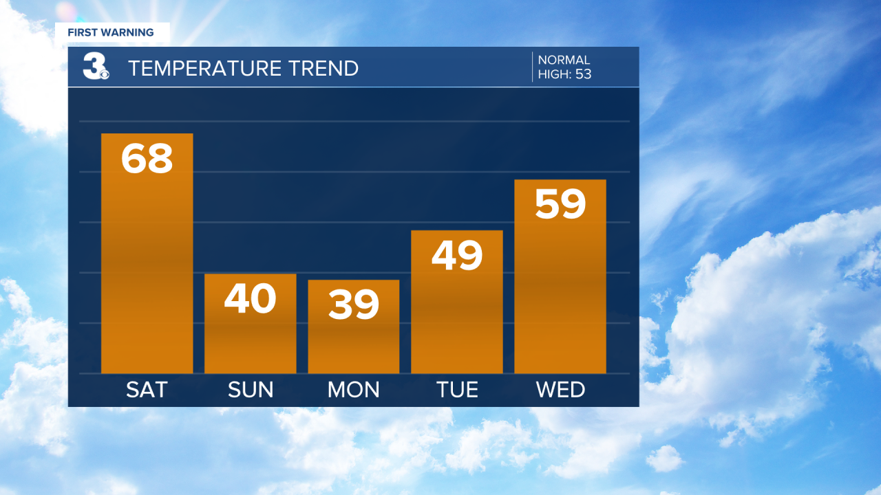
A warm front to our north starts to bring in warmer air tonight. Despite a clear sky, overnight lows will only drop into the mid 40s. Saturday warms into the upper 60s and low 70s as clouds gradually increase. A cold front Saturday night ushers Winter back in.
Temperatures Sunday gradually drop throughout the day. Rain transitions into snow falling throughout Sunday morning. Precipitation tapers off Sunday afternoon. With a warm ground and not a lot of moisture in this system, we're not expecting much in terms of snow accumulation. For most only a light dusting. Up to 1" across the Eastern Shore.

The greater concern will be slick spots developing on the road Sunday night from anything wet on the ground freezing over. Lows drop to the mid 20s.
The workweek starts off mostly dry and cold. A few lingering flurries are possible Monday morning, but they won't amount to anything. Highs Monday in the upper 30s with clearing clouds.
High pressure brings us lots of sunshine Tuesday and Wednesday as well as warmer temperatures. Highs in the upper 40s Tuesday warm to the upper 50s Wednesday. We could even hit 70° Thursday!
A slowly approaching cold front late-week brings scattered showers late Thursday into Friday. Friday stays warm with above-average temperatures in the upper 60s.
Connect with Meteorologist Kristy Steward:
