


Meteorologist Kristy Steward's First Warning Forecast
Good Wednesday night! Today was a gorgeous day! We’ll continue to stay decently dry, but those temperatures will continue to climb to sweltering levels.
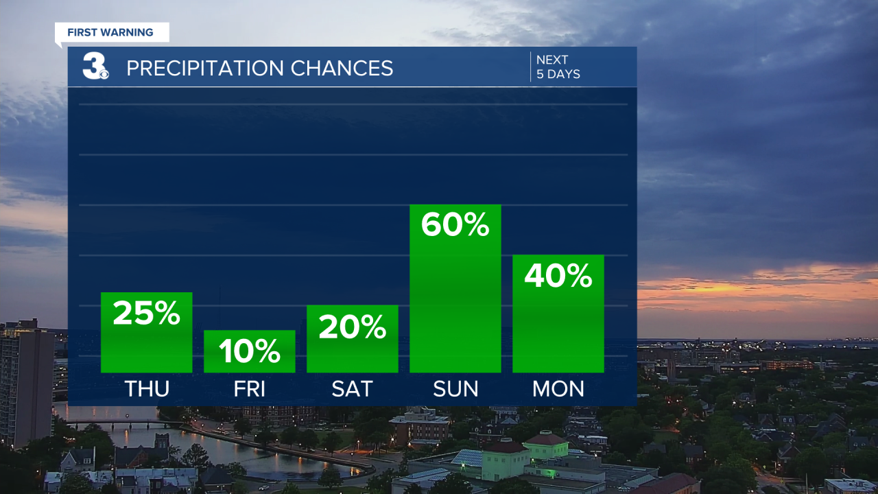
Late tonight, a warm front will pass through. That keeps temperatures warm in the low to mid 60s, but also brings us lighter isolated to scattered rain showers late tonight into early Thursday morning. Thursday afternoon and evening we could have a shower/storm or two pop-up. More scattered showers and storms will be likely later Thursday night into early Friday morning.
There’s a level 1 out of 5 risk for severe weather Thursday for areas along and south of the Albemarle Sound.

The main things we’ll notice from this warm front are soaring temperatures and humidity. Strong 10-20 MPH southwesterly winds help pump in that moisture and heat from down south. Highs Thursday in the upper 80s keep climbing to the low 90s Friday and likely mid 90s for some Sunday. With higher humidity, it will feel like we’re closer to 100° this weekend. Get ready for sweltering summer heat!
A cold front early Monday morning will bring us scattered storms late Sunday. Then we move into an unsettled pattern for the beginning of next week. That will keep us with scattered showers Monday into Tuesday morning. Temperatures will be cooler around 70° to kick off the workweek. Wednesday we dry out and warm up to 80° again.
Connect with Meteorologist Kristy Steward:
