


Meteorologist Kristy Steward's First Warning Forecast
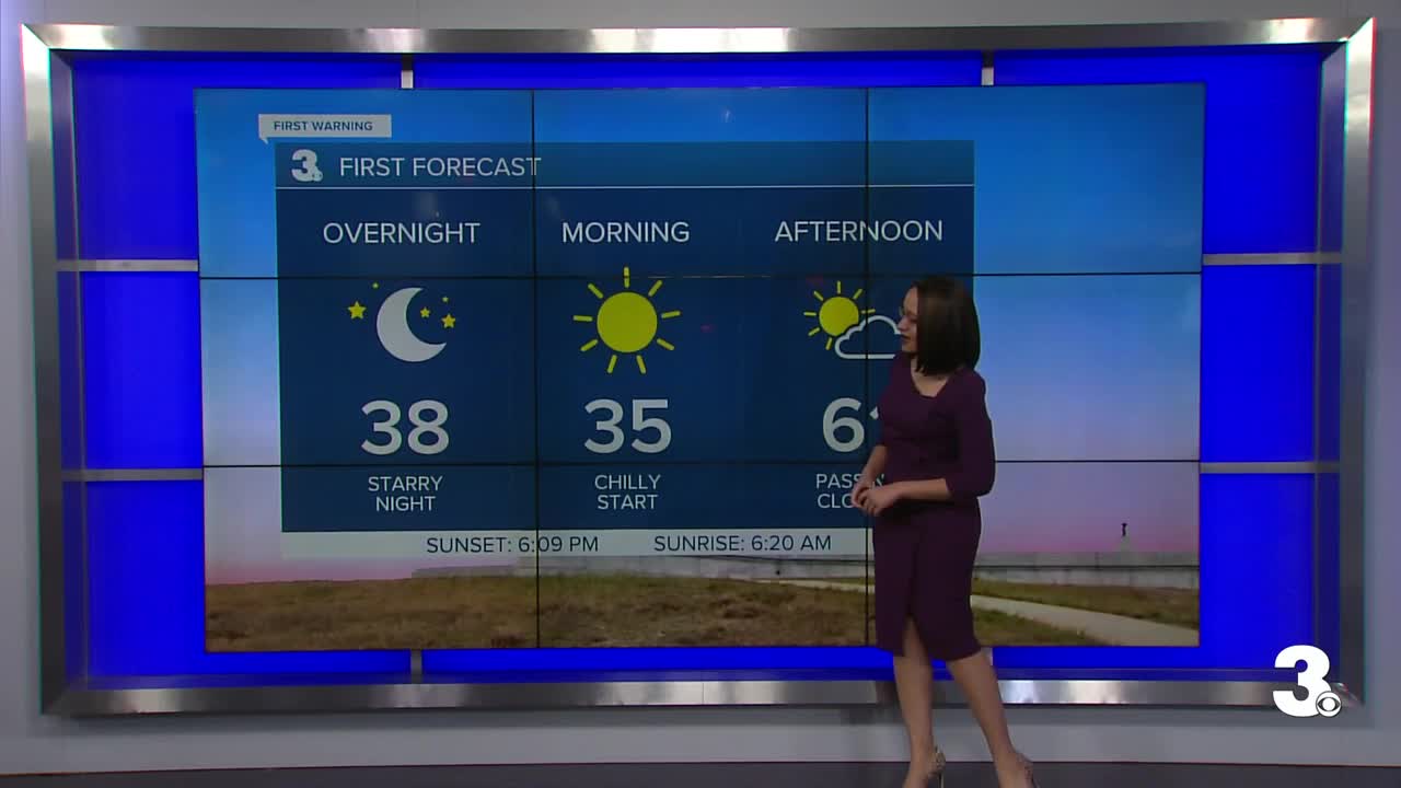
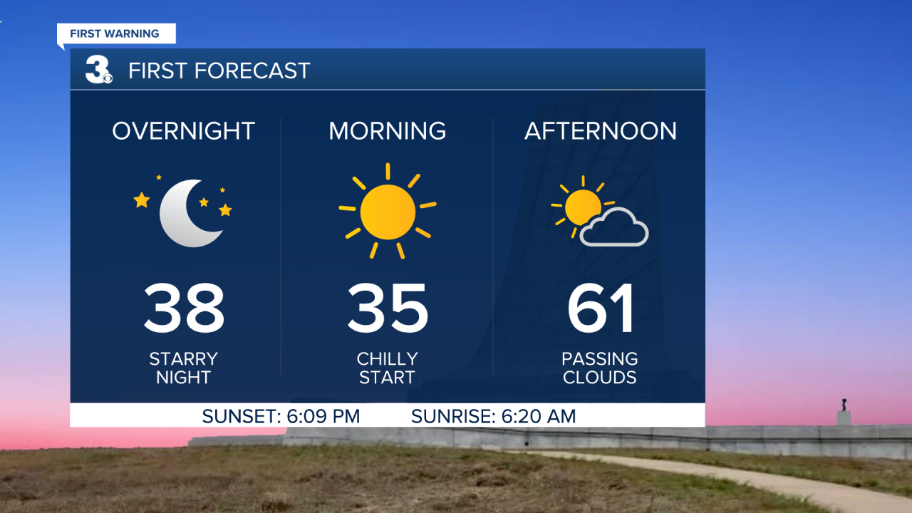
Good Sunday night! The sunshine today was deceiving. It looked beautiful outside, but didn't feel quite so nice with temperatures in the mid 40s. Fortunately, a nice warm-up is headed our way!
Tonight will still be chilly with lows reaching the mid 30s under a clear sky. Southerly winds Monday and a good amount of sunshine will help temperatures reach the low 60s Monday afternoon. We'll also have passing clouds throughout the afternoon.
Clouds and sunshine continue Tuesday. Temperatures climb into the mid to upper 60s too. Mid-week, a low pressure system riding along the coast will bring us a slight shift in our weather.
Wednesday afternoon/evening, some isolated to scattered showers look to mainly impact Dare county. All of us have a chance at seeing scattered rain showers throughout the day Thursday. Both days will stay mild with highs in the low to mid 60s and lots of cloud cover.
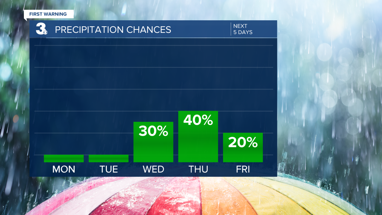
Behind this system, temperatures return to the low 70s to kick off the weekend. A cold front late Saturday looks to bring us a few isolated showers throughout the day Saturday and slightly cooler air for Sunday. Highs in the low to mid 60s next Sunday with dry weather and a mix of sun and clouds.
Connect with Meteorologist Kristy Steward:
