


Meteorologist Kristy Steward's First Warning Forecast
Happy Wednesday evening! It has been a very wet day with drenching rain for most of it. We have a little bit of a dry break coming before more wet weather arrives this weekend.
Scattered rain becomes more isolated tonight into Thursday morning. Some patchy fog is possible Thursday morning too. The second half of the day, we’ll have some sunshine breaking through the clouds and high temperatures warming to around 60°.
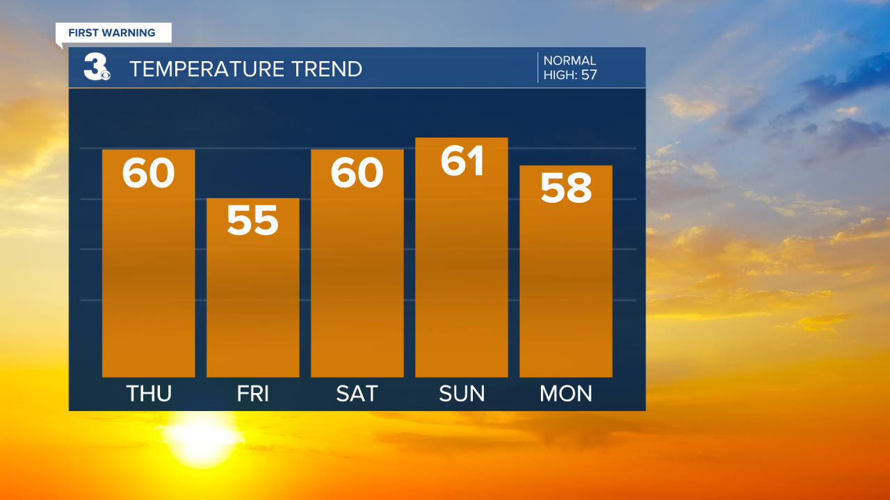
Friday stays dry, but it will be cooler. Highs in the mid 50s. We return to the low 60s for the weekend.
Saturday is when you’ll need the rain gear again. Widespread rain returns. A few showers could linger into Sunday, but Sunday is looking a lot drier than Saturday.

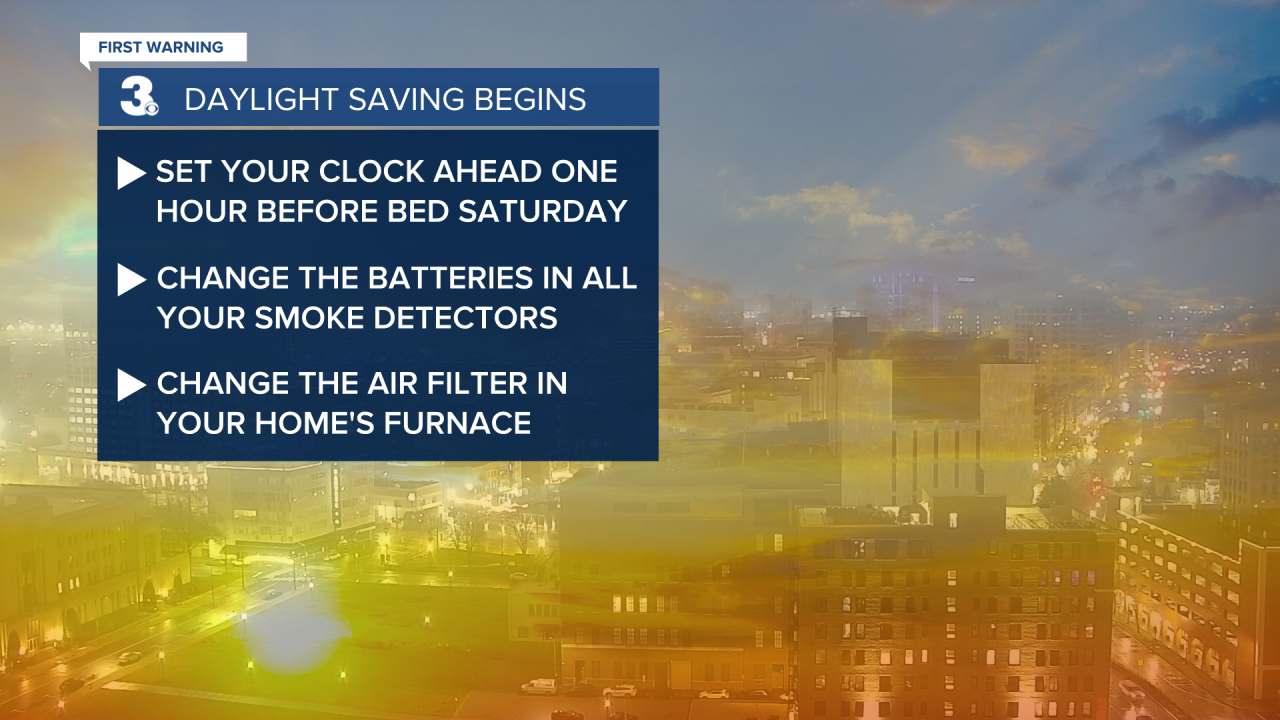
Don’t forget, Daylight Saving Time begins this weekend! At 2 AM Sunday, we’ll lose an hour of sleep as clocks spring forward one hour. This is a good time to change your smoke detector batteries and air filters in your home.
Next week is trending much drier with a lot more sunshine. Temperatures will be a little cooler in the upper 50s Monday and gradually warm to the upper 60s Wednesday.
Connect with Meteorologist Kristy Steward:
FACEBOOK
TWITTER
INSTAGRAM
