


Meteorologist Kristy Steward's First Warning Forecast
Happy Saturday night! We got to enjoy cooler temperatures today with highs in the mid to upper 80s. Same temperatures for Sunday, but scattered storms return. Eventually the high heat and humidity returns too.
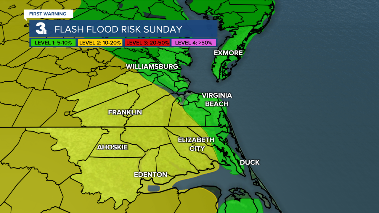
Tonight will be a little cooler with lows in the lower 70s. Dry overnight with increasing clouds. Clouds continue to increase Sunday morning ahead of scattered storms Sunday afternoon and evening. The good news is the severe threat has shifted away from us, but we will still see some storms Sunday. Those storms could lead to localized flash flooding within heavy downpours. Not a washout, but a good idea to keep an umbrella or rain jacket handy and a closer eye on the road in the PM hours. High temperatures return to the mid and upper 80s.
A few degrees warmer Monday in the upper 80s. More scattered showers and storms for Monday afternoon and evening.
The rest of the workweek will be more of a typical summertime pattern for us. Highs in the low to mid 90s with isolated PM pop-up storms. Feels-like temperatures will be back in the triple digits.
Next weekend we should cool down again to the mid to upper 80s.
Connect with Meteorologist Kristy Steward:
FACEBOOK
TWITTER
INSTAGRAM
