


Meteorologist Kristy Steward's First Warning Forecast
Good Wednesday night! It’s been a dreary day with clouds, mist and drizzle. Expect more wet weather over the next few days and possibly some severe storms.
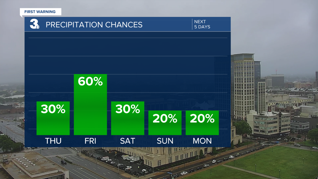
Fog, mist and drizzle continues tonight into Thursday morning. Temperatures remain stable in the low to mid 60s overnight. Later Thursday, we dry out and could see some brief peeks of sunshine. High temperatures will be near 80°.
Friday starts off pleasant. Temperatures in the upper 60s warm to the mid 80s. Dry and breezy in the morning turns stormy in the afternoon and evening. We will have a couple lines of strong to severe storms moving through. Almost all of us are under a Level 2 of 5 risk for severe weather already. We’re mainly concerned about damaging winds, large hail, and heavy downpours. Stay tuned for more fine-tuned forecast updates as this event gets closer.


A cold front earlier Saturday will bring us a few showers, but not much in the way of cooler temperatures. Highs stay in the low to mid 80s through the holiday weekend and into the start of the workweek.
Sunday and Memorial Day will be drier and we’ll finally start to see more sunshine outside. Great weather for any holiday celebrations!
We stay mostly dry and partly cloudy Tuesday and Wednesday. Temperatures become more summer-like Wednesday as we touch 90°.
Connect with Meteorologist Kristy Steward:
