


Meteorologist Kristy Steward's First Warning Forecast
Happy Thursday evening! We sure noticed that jump in heat and humidity today. Highs in the upper 80s to low 90s. Temperatures climb a little more heading into this weekend and storm chances go up.
A little warmer tonight with lows around 70°. Partly cloudy with patchy fog possible again.

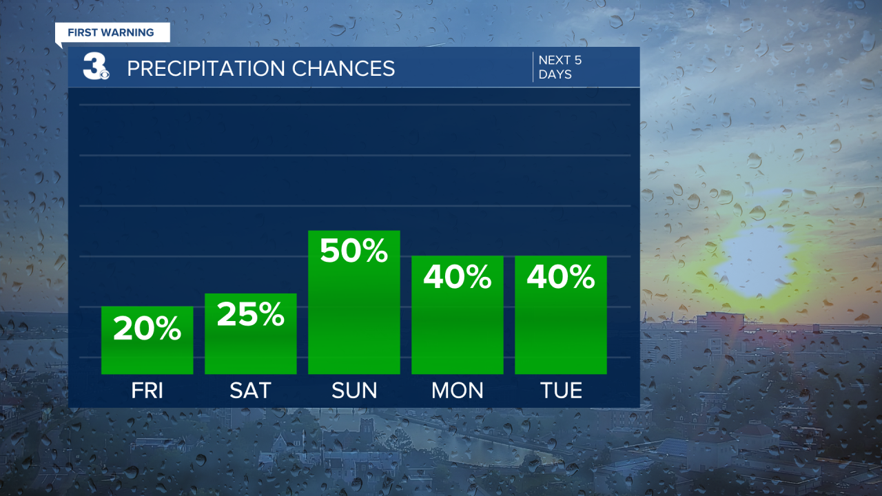
High temperatures climb into the low 90s Friday, feeling like the low 100s. We should stay mostly dry, but afternoon storms could pop-up, especially across inland North Carolina. To help with the heat a tiny bit, we will have a southerly breeze again.
A few more spotty storms are possible Saturday, but still a lot of areas should remain dry. Partly cloudy again with highs in the low 90s, feeling like the low 100s.
More scattered storm activity begins Sunday and sticks around through next week. An approaching cold front will stall just to our north and it’ll likely carry some moisture from that potential tropical system in the Gulf with it. That’s why we stay with off and on rounds of scattered storms each day from Sunday on. Not a washout any day and the actual Fourth of July looks decently dry around firework time.
This stormy pattern will cool us down slightly. Highs in the mid to upper 80s, feeling like the mid 90s each day.
Tropical Update:
Potential Tropical Cyclone Two is just north of Colombia and Panama. It’s moving west at 21 MPH with 40 MPH sustained winds. It has an 90% chance of formation both in the next 48 hours and next 5 days. This storm will likely become our second named of the season, Bonnie.

The other area being watched is in the Gulf of Mexico near the Texas coastline. This one has a 30% chance of formation in both the next 48 hours and next 5 days. It will bring heavy rain across Texas the next few days, regardless of formation and some of that moisture could make its way to us next week.

Connect with Meteorologist Kristy Steward:
FACEBOOK
TWITTER
INSTAGRAM
