


Meteorologist Kristy Steward's First Warning Forecast
Good Thursday night! Slow-moving scattered storms brought us a nice cool down from the mid 90s to the mid 70s this evening, but they won’t be cooling us down for long. High heat and humidity continues for several more days.
Storms quickly dissipated once we lost our daytime heating. Partly cloudy and dry overnight with lows in the mid 70s.
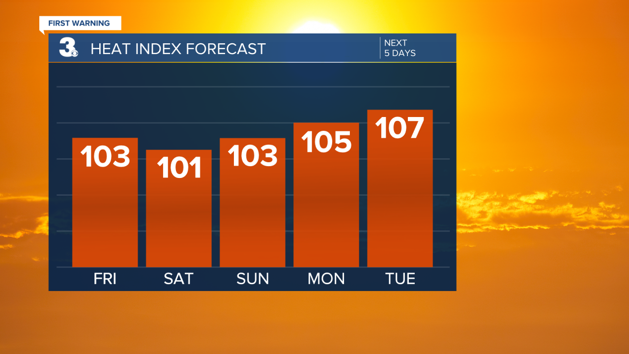
Staying toasty this weekend and much of next week. High temperatures each day in the low to mid 90s, feeling like 100-110°. Isolated to widely scattered storms Friday afternoon and evening, then mostly dry until Tuesday afternoon and evening when more isolated storms return.
A cold front Wednesday will bring us scattered storms and finally a decent cool down. High temperatures in the mid to upper 80s next Thursday.
Connect with Meteorologist Kristy Steward:
FACEBOOK
TWITTER
INSTAGRAM
