


Meteorologist Kristy Steward's First Warning Forecast
Happy Friday evening! It has been a very windy day! Winds remain elevated through the weekend, kicking up more pollen.
As the low pressure system that brought us nasty weather Thursday night continues to move north and a high pressure system starts to settle in, winds will remain gusty. Tonight, expect gusts around 25 MPH, picking back up to 35 MPH gusts Saturday afternoon.

Sunday will be a little bit less windy with a calmer morning, but gusts picking up to 25 MPH in the afternoon and 30 MPH gusts in the evening. Still breezy Monday morning with 20 MPH gusts.

Outside of the wind, it will be a very nice weekend. Dry with plenty of sunshine. Highs Saturday in the upper 60s make a jump into the upper 70s Sunday.
This warming trend continues into the workweek. Highs around 80° Monday. We briefly drop to the mid 70s Tuesday, then return to the low 80s Wednesday. We even touch the mid 80s Thursday before falling back down to the mid 70s Friday.

Majority of the workweek is looking dry with a mix of sun and clouds. We could see some isolated to scattered rain showers Friday.
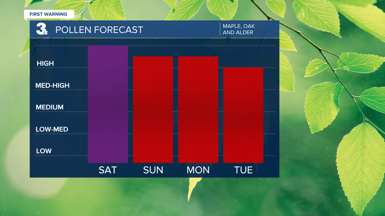
Having a dry, windy stretch unfortunately means pollen levels stay high for the foreseeable future.
Connect with Meteorologist Kristy Steward:
FACEBOOK
X
INSTAGRAM
