


Meteorologist Kristy Steward's First Warning Forecast
Happy Father’s Day & Juneteenth! We could not have asked for better weather today! This beautiful weather will continue for a couple more days, then the heat starts to return and storm chances start to increase.
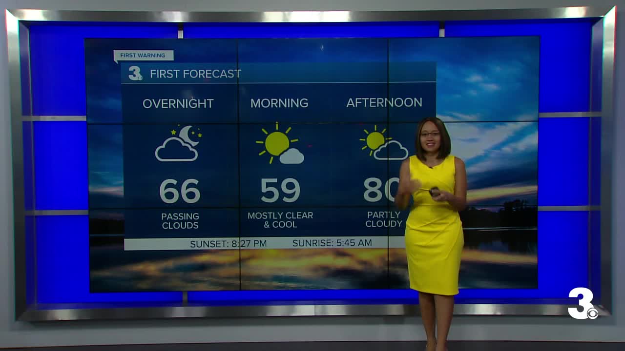
Winds calm down tonight. We’ll have passing clouds, but remain dry. Cool again with lows in the mid 50s inland and low to mid 60s along the coast.
Pleasant Monday with highs around 80°, a mix of sun and clouds, and dry. Our Canadian high pressure system exits the region Tuesday and we move into an unsettled pattern.
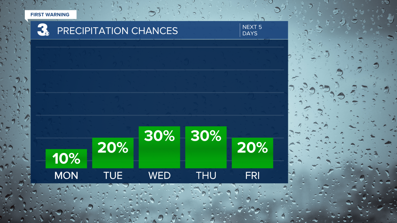
Highs will still be in the low 80s Tuesday and we’ll be mostly dry, but we’ll have a lot more cloud cover. A more summertime pattern begins Wednesday. Highs in the mid 80s for the rest of the workweek and upper 80s next weekend. We'll have near daily chances for isolated storms popping up Wednesday through next weekend.
Connect with Meteorologist Kristy Steward:
