


Meteorologist Kristy Steward's First Warning Forecast
Good Saturday night! We’ve survived the hottest day of the year so far! Highs reached the mid 90s, feeling like 100-110°. This same heat continues Sunday. However, an end to this heat is finally in sight!
We stay warm under a mostly clear sky tonight. Lows again in the mid 70s.
Sunday will be just as hot as Saturday was. Highs in the mid 90s, feeling like 105-110°. There will be more sunshine Sunday. While we won’t have as many pop-up storms to help cool us down, there will be stronger winds to help us beat the heat. 10-20 MPH south-southwest winds gusting up to 30 MPH.
The workweek starts off just as hot. Highs in the mid 90s, feeling like the low 100s Monday. Monday evening scattered storms start to move through. That will kick off our stormy, unsettled pattern.
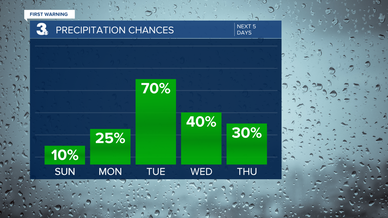
Scattered storms will continue daily, mainly in the afternoon and evening hours, from Tuesday through Friday. Some isolated storms will still be possible next Saturday. This stormy activity will help briefly cool us down Tuesday to seasonal highs in the upper 80s. It will only be a brief dip into the 80s though as temperatures return to the mid 90s, feeling like 105-110°, by Thursday.
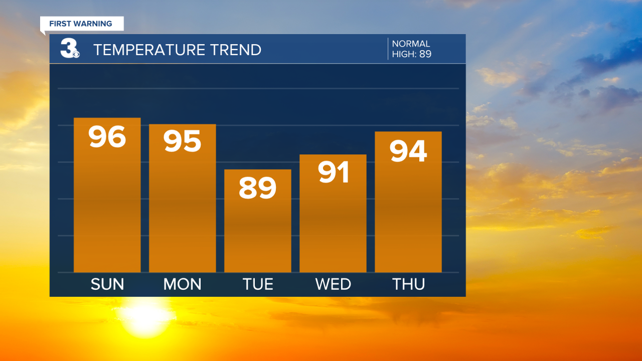
Finally, the Bermuda High offshore that’s been keeping us so hot will break down and a cold front should be able to pass through on Saturday. That will likely put an end to our heat wave and drop highs into the mid 80s for at least the start of next weekend.
Connect with Meteorologist Kristy Steward:
FACEBOOK
TWITTER
INSTAGRAM
