


Meteorologist Kristy Steward's First Warning Forecast
Good Thursday night! It was an active afternoon with strong storms moving through. Luckily, the worst of the storms stayed all around us. We only had one severe thunderstorm warning in inland Virginia.
Tonight will be drier, although a few lingering showers are possible. Clouds begin to clear lat tonight. Winds remain breezy. Overnight lows stay mild in the low 60s.
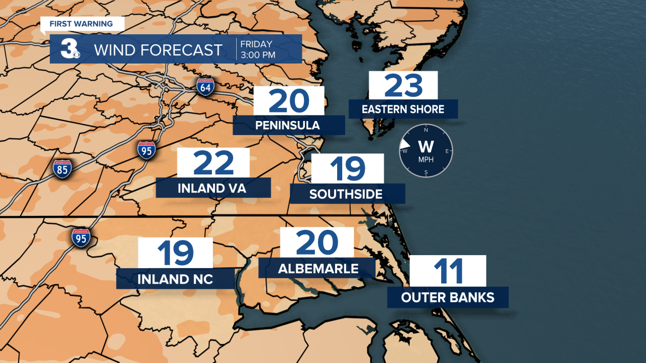
Friday will be a mostly dry and cooler day, but it will still be windy. 15-20 MPH westerly winds gusting to 30 MPH. Clouds also continue to gradually clear.
This weekend starts off much cooler. Highs around 60° Saturday. Saturday will be dry with a mix of sun and clouds and light winds. A little warmer Sunday in the upper 60s. Sunday morning we could have a few isolated showers popping up with a disturbance passing through.
Back to the mid 60s Monday with tons of sunshine to enjoy. Clouds start increasing Tuesday and Wednesday ahead of our next system. That system will warm us up to the low to mid 70s for the middle portion of the workweek. Scattered showers and storms are likely Wednesday into Thursday.
Connect with Meteorologist Kristy Steward:
