


Meteorologist Kristy Steward's First Warning Forecast
Happy Sunday night! Temperatures were a little warmer again today, but we had a nice breeze to enjoy. Breezy winds stick around a couple more days as a cold front passes through. Also expect dropping temperatures and scattered storms with the front.
Well ahead of the cold front, clouds will begin to increase late tonight. We stay with breezy 10-20 MPH south winds keeping us warmer around 70° for lows.
Clouds continue to increase throughout Monday morning and we stay breezy. Highs reach the mid 80s. Scattered showers and storms look to start moving in around 3-4 PM and continue into Monday night. By sunrise Tuesday, these showers will be out of Virginia and inland North Carolina, but still lingering around the Albemarle Sound and Outer Banks. Showers should clear out of the rest of North Carolina by Tuesday afternoon.
Tuesday will stay a bit breezy, but it will be cooler. Highs in the mid to upper 70s. If you like cooler air, enjoy Tuesday because temperatures will gradually be on the rise again starting Wednesday.
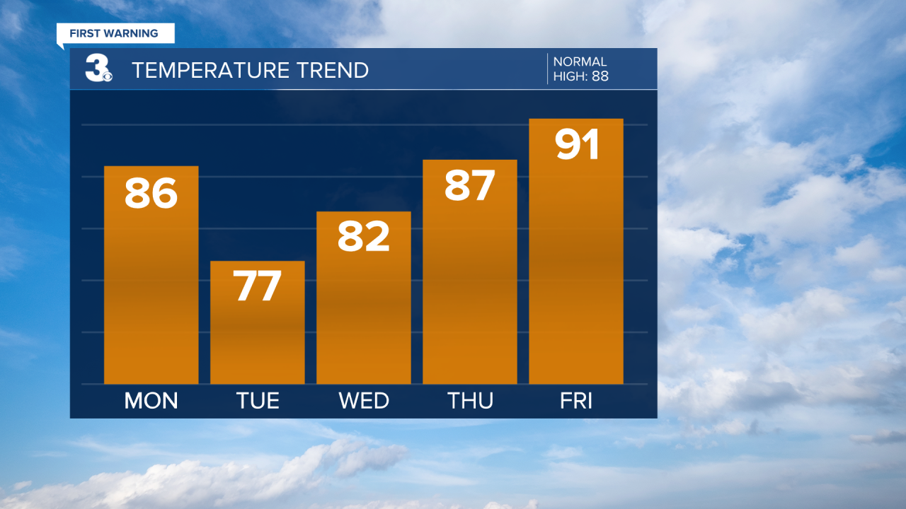
High temperatures gradually climb into the low 90s by Friday and stay there throughout next weekend.
The second half of the workweek and start to next weekend looks decently dry. We get breezier next weekend ahead of another approaching cold front. That front could bring isolated storms late in the day Sunday.
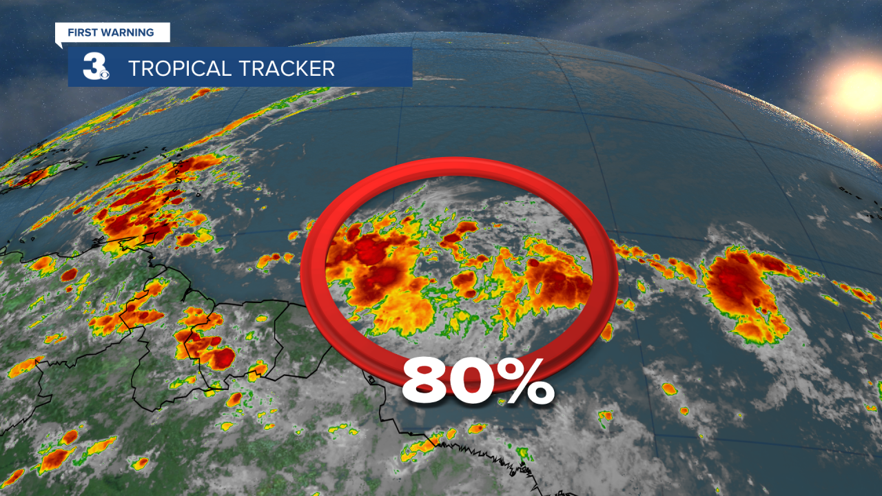
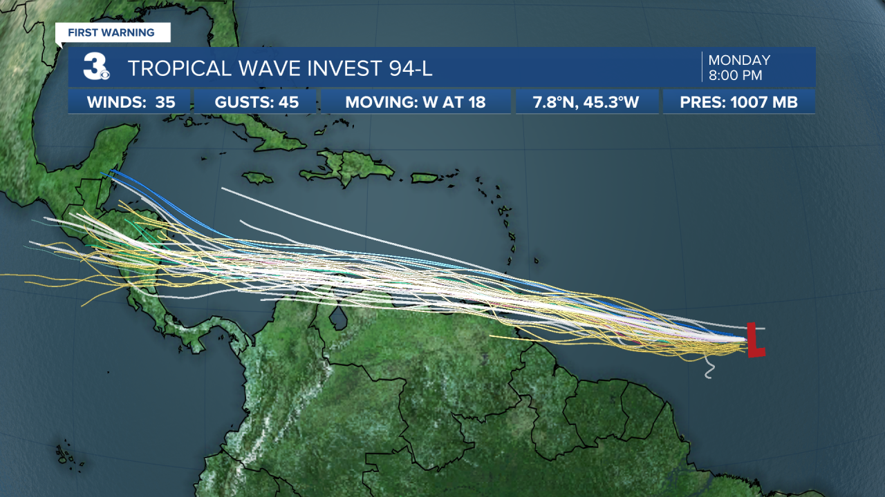
Tropical Update:
The area of disorganized showers and storms in the middle of the tropical Atlantic, about 1000 miles ESE of the Windward Islands, now has a 60% chance of formation in the next 48 hours and 80% chance of formation in the next 5 days. It’s expected to reach the Windward Islands Tuesday and at least bring heavy rainfall. It could potentially become our second named tropical system of the season, Bonnie.
Connect with Meteorologist Kristy Steward:
