


Meteorologist Kristy Steward's First Warning Forecast
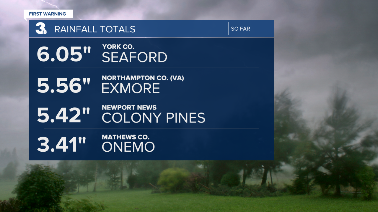
Good Thursday night! It has been a soggy, active day. Some locations have received over 6" of rain with more rain falling. Localized flooding is possible. If you come across a flooded roadway, turn around and find an alternate route.
Scattered light to moderate rain showers continue through the night into earlier Friday morning. Then we'll have a series of cold fronts passing through the rest of this weekend.
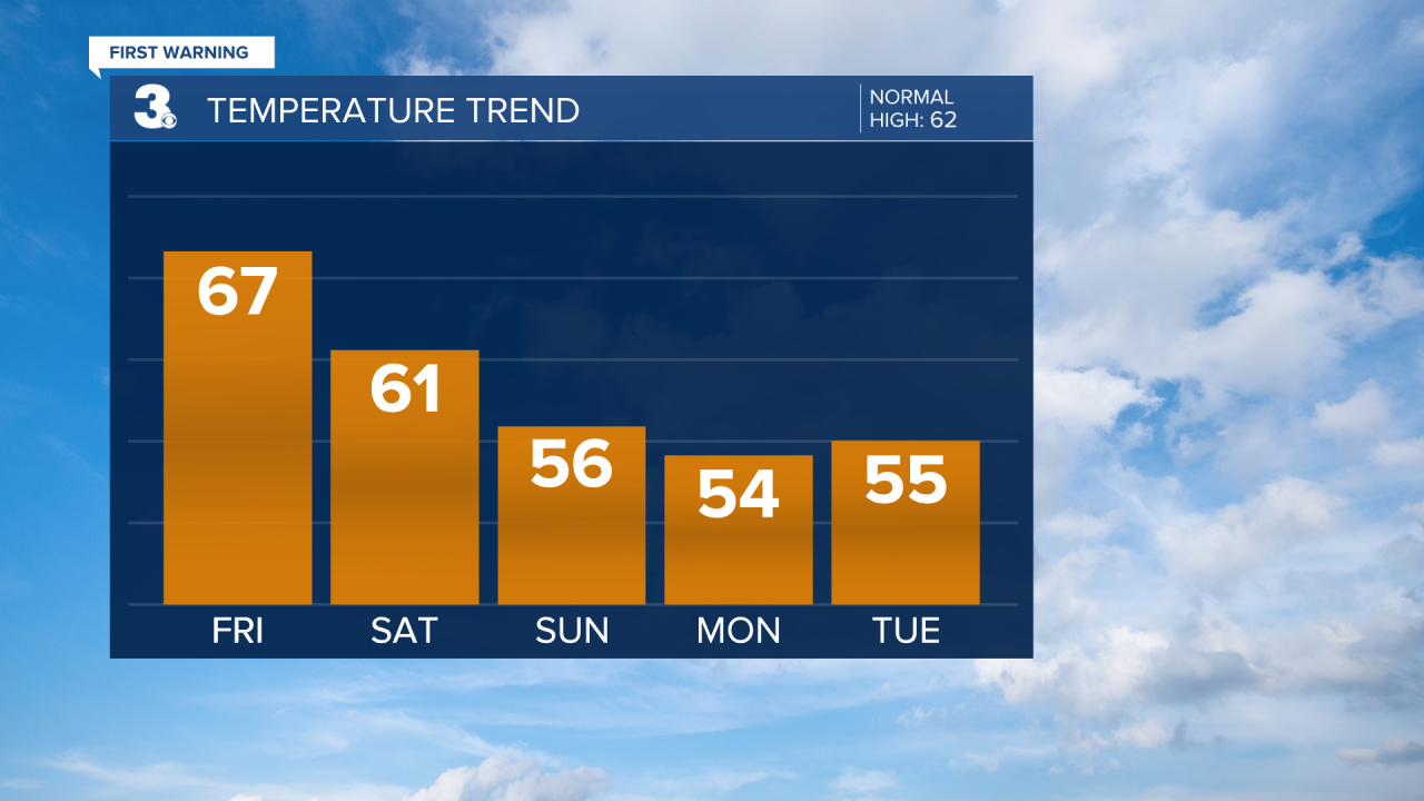
High temperatures Friday will be in the mid to upper 60s. Mostly dry with clearing clouds. Partly cloudy and cooler Saturday with high temperatures in the low 60s. We could see isolated to widely scattered rain showers as a cold front sweeps through Saturday afternoon and evening. This front will cool us down to the mid 50s by Sunday.
Another cold front heads our way Sunday afternoon. This one will be drier, so we're not expecting precipitation around it, but it will bring us stronger winds and drop temperatures again. Overnight lows plunge into the low to mid 30s. Take precautions to protect your sensitive plants Sunday night. High temperatures remain in the mid 50s Monday and Tuesday, but overnight lows will gradually rise. Mid to upper 30s Monday night and low to mid 40s Tuesday night.
The workweek starts off dry and partly cloudy. The cold front that sweeps through Sunday will stall to our south and eventually lift north again as a warm front. The warm front will pass through Hampton Roads Wednesday morning. That will help temperatures warm into the upper 60s Wednesday and mid 70s Thursday. Clouds begin to increase Thursday ahead of a cold front, but we should stay mostly dry. Rain could arrive again by Friday along with another potential cool down behind the cold front.
Meteorologist Kristy Steward
