


Meteorologist April Loveland's First Warning Forecast
60s, 70s, 80s and storms. What days this week will be the warmest, coolest and when you'll need to keep an eye on the sky!
Summer-like warmth moves in today with highs in the low 80s under a nice mix of sun and clouds. Great day to be out and about! It will be a bit on the breezy side.
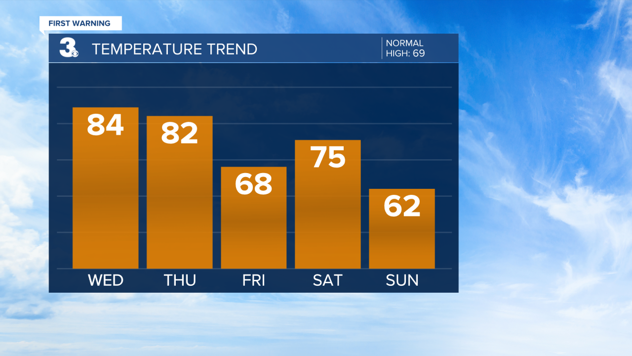
The warm temperatures continue on Thursday with highs in the low 80s. We are tracking storms on the way by the late afternoon and evening hours. The entire area is under a level 1 for severe storms. The biggest threat will be damaging wind gusts, heavy rain and hail. Keep an eye on the sky!


We'll dry out but also cool down to end the work week. Highs will be in the upper 60s which is normal for this time of year. Skies will clear as the day progresses.
A few spotty showers will be possible on Saturday, but temperatures will warm to the mid 70s.
Easter Sunday is looking dry and cool with highs in the low 60s under partly sunny skies.

We'll enter an unsettled weather pattern to kick off the work week. Highs will be in the low and mid 60s with a chance for scattered showers.
Meteorologist April Loveland
For weather updates on Facebook: HERE
Follow me on Twitter: HERE
Follow me on Instagram HERE
Check out the Interactive Radar on WTKR.com: Interactive Radar
