


Meteorologist Kristy Steward's First Warning Forecast
Good Sunday night! The gloomy weather we had earlier today has now cleared out and we'll have a lot of sunshine to enjoy throughout the workweek.
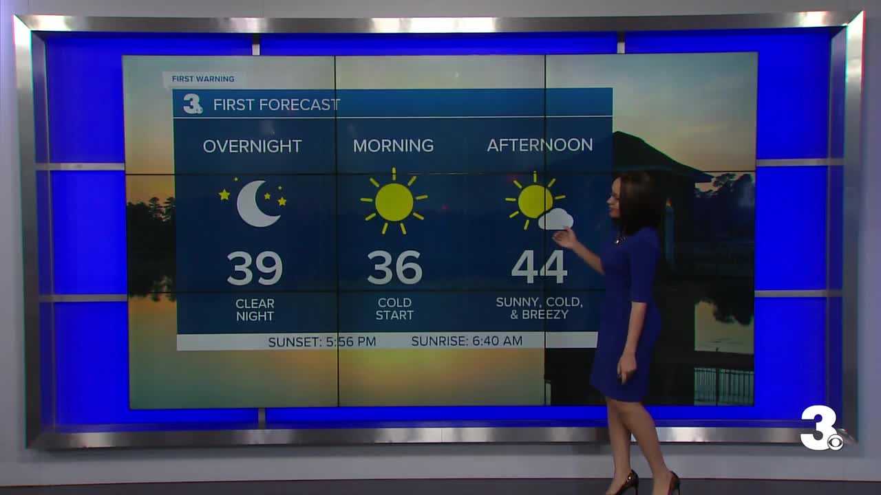
A weakening cold front will pass through tonight, then high pressure starts to settle in. This will bring us breezy northerly winds of 10-20 MPH late tonight throughout Monday as well as cooler temperatures. Down to the mid 30s tonight. Highs on Monday in the mid 40s.
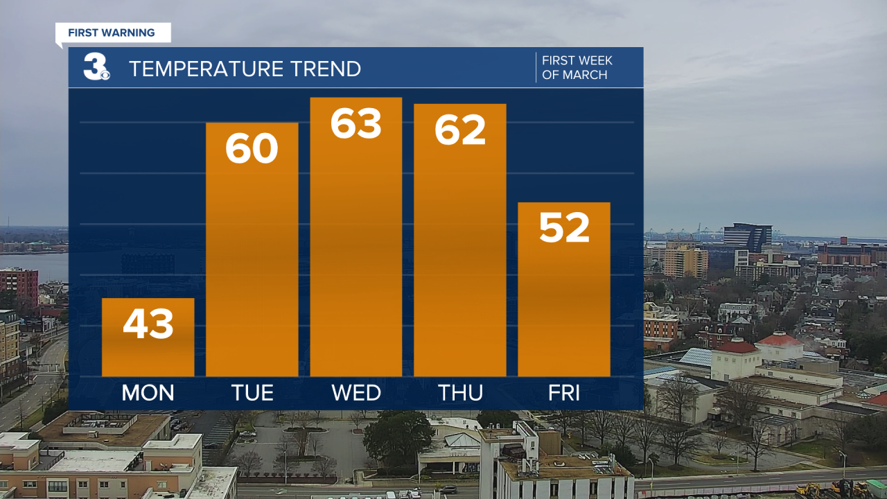
Lots of sunshine continues for majority of the workweek. March brings a warming trend with it. Highs in the upper 50s Tuesday climb to the mid 60s Wednesday. On Thursday night, a cold front will pass through. It could bring us isolated to scattered showers Thursday night, but there's a lot of variability between models with how much moisture this front will carry. It will definitely usher in colder air again. Highs back down to the upper 40s on Friday.
A slowly approaching system next weekend brings us more cloud cover and warmer air. Highs return to the mid 60s Saturday and low 70s Sunday. Most of the weekend looks dry right now as that system isn't set to pass through until the workweek.
Connect with Meteorologist Kristy Steward:
