


Meteorologist Kristy Steward's First Warning Forecast
Good Saturday evening! It was messy most of the day. That coastal low has now moved out to sea, but it leaves behind strong winds that will create other issues along the coast.
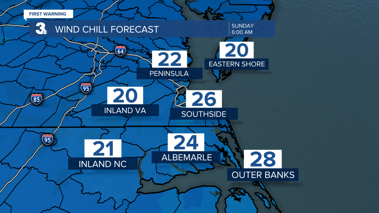
Clouds clear tonight allowing temperatures to drop into the upper 30s. However, with stronger 15-25 MPH north winds gusting to 50 MPH, it will feel like temperatures are in the low to mid 20s when you wake up Sunday morning.
Sunday will be a day full of sunshine. High temperatures warm to around 50°. North winds get stronger though. 20-30 MPH gusting to 50 MPH. Monday stays about the same, slightly less windy. 10-20 MPH northeast winds gusting to 30 MPH. Highs in the mid 50s.
With such strong winds the next couple days, tidal flooding and coastal flooding are concerns. A Wind Advisory is in effect for all of our coastal communities until 8 PM Sunday. Those 50 MPH wind gusts could cause power outages, tree limbs to fall, and make it difficult for high profile vehicles to drive.

A High Surf Advisory is in effect for the Eastern Shore and Virginia Beach until 8 AM Tuesday and for the Outer Banks until 8 AM Wednesday. We’ll have 8-12’ breaking waves. This will bring 2-4’ of inundation in the Outer Banks. Expect ocean overwash, beach erosion, roads to be closed, and potential property damage. A Coastal Flood Warning is in effect for the Outer Banks until 2 AM Tuesday and a Coastal Flood Advisory is in effect for mainland Dare County until 8 PM Monday for those reasons.


Around the Chesapeake Bay, tidal flooding will be a concern. Nuisance flooding begins 10 AM Sunday with increasing trouble in flood-prone areas each high tide cycle through Tuesday. We’ll be in elevated tidal flooding stages.

The middle of the week, Wednesday and Thursday, another low pressure system rides along the coast bringing us more rain and windy conditions. Highs in the upper 50s to low 60s.
Lots of sunshine returns Friday and the weekend is looking mostly dry. Winds stay elevated and temperatures continue to warm. Upper 60s next Saturday.
Connect with Meteorologist Kristy Steward:
FACEBOOK
TWITTER
INSTAGRAM
