


Meteorologist Kristy Steward's First Warning Forecast
Temperatures will continue to climb as we head into the weekend – possibly breaking records.
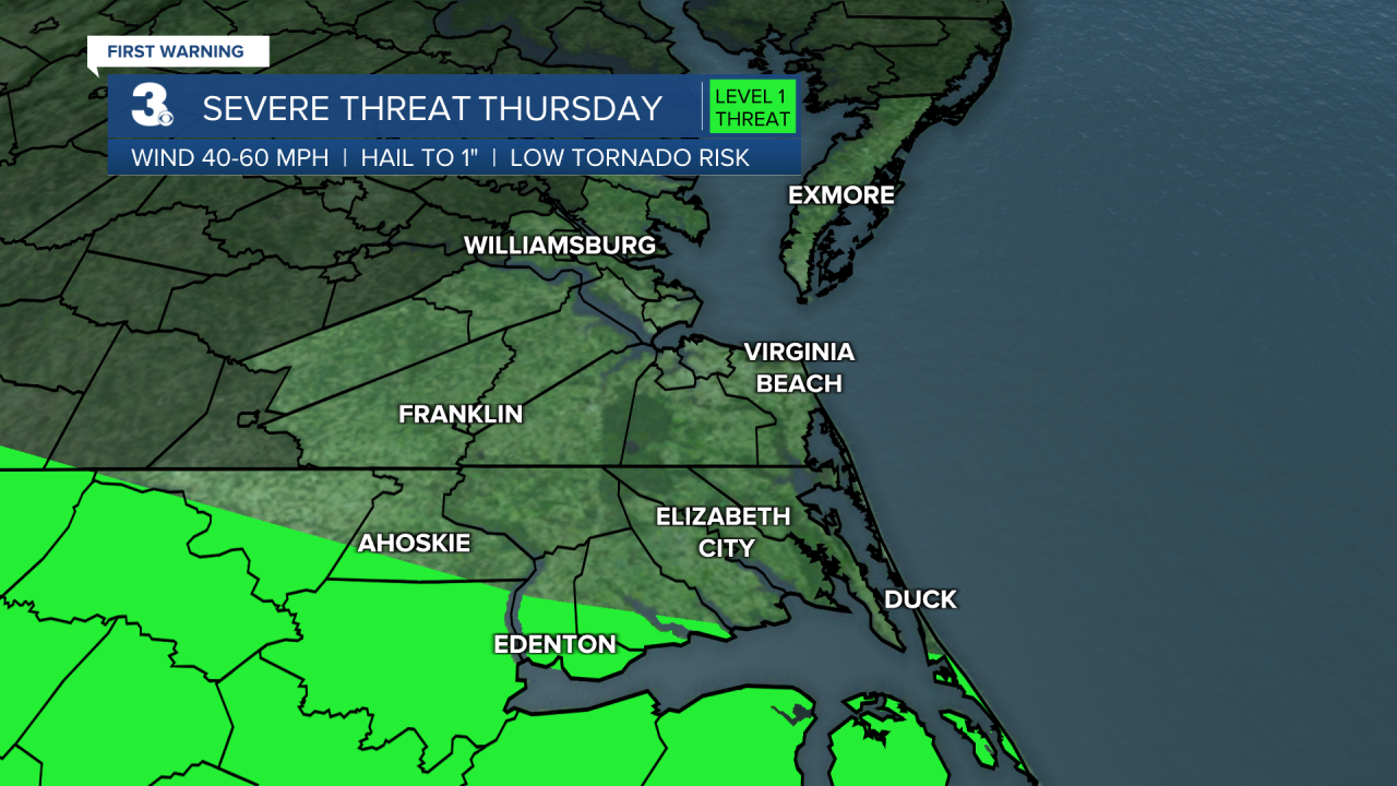
We could have isolated storms pop-up overnight mainly across North Carolina. Our North Carolina communities near the Albemarle Sound are under a Level 1 threat for severe storms this evening into tonight. The main concerns are damaging wind gusts and hail. A lot of us remain dry tonight, partly cloudy, and warm. Lows in the upper 60s.
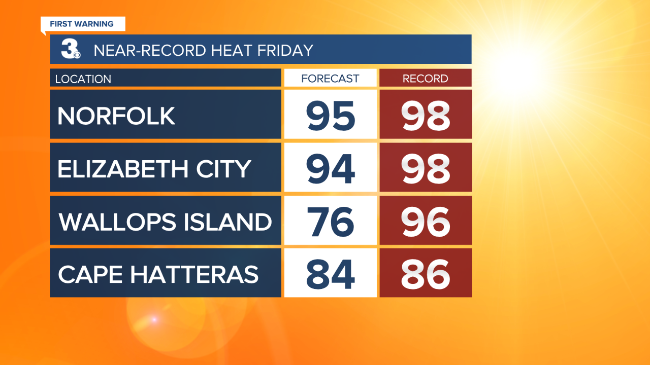
We’ll be in for scorching heat Friday and Saturday. Close to records Friday with highs in the mid 90s and likely breaking record highs Saturday with forecasted highs in the mid to upper 90s. The record for 5/20 is 98° and the record for 5/21 is 94°, both set in 1996. Feels-like temperatures will be in the low 100s. Temperatures will be able to climb so high because we’ll have tons of sunshine, dry conditions, and breezy southwesterly winds continuing to pump in warmth and moisture from down south.
Eventually, a cold front heads our way early Monday morning. That will spark scattered storms later in the day Sunday lasting throughout Monday. Temperatures will be a little cooler Sunday, but still hot in the upper 80s. We return to seasonable normals in the upper 70s Monday and reach our coolest point of the week Tuesday with highs in the upper 60s following the cold front.

That cold front stalls to our south, keeping us in a wetter pattern Tuesday and Wednesday. Then, the front lifts north as a warm front later Wednesday and sends our temperatures back on the rise. Highs in the upper 70s Wednesday rise to around 80° Thursday. With an approaching cold front Thursday, isolated storms will still be possible.
Connect with Meteorologist Kristy Steward:
