


Meteorologist Kristy Steward's First Warning Forecast
Happy Saturday evening! It was a nice day, but still on the windy side. Winds start to die down some on Sunday and temperatures will make a jump.
Under a clear sky tonight, temperatures fall to the upper 40s. Winds will be on the lighter side tonight. We get breezy Sunday afternoon and evening. Southwesterly winds 10-20 MPH gusting to 30 MPH. Temperatures will soar into the upper 70s, near 80°. Lots of sunshine continues all day.

Temperatures stay warm in the low 80s Monday. A cold front Monday evening will bring us isolated storms Monday evening and early night. This front drops temperatures to the low 70s for highs Tuesday.
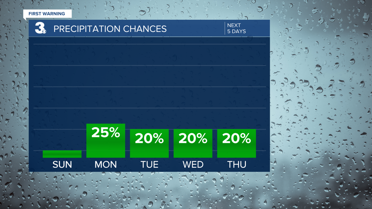
The middle of the week looks mostly dry, but can’t rule out a stray shower each day. Temperatures return to around 80° Wednesday and Thursday. Then, temperatures start on a cooling trend. Highs in the mid 70s Friday and upper 60s Saturday.

Around a cold front Friday, we could see isolated rain showers.
Pollen levels remain high for the next week.

Connect with Meteorologist Kristy Steward:
FACEBOOK
X
INSTAGRAM
