


Meteorologist April Loveland's First Warning Forecast
The heat is on for the next few days as highs soar to the 90s, before a cold front brings cooling storms.
Hot and more humid today with highs in the low 90s under mostly sunny skies.
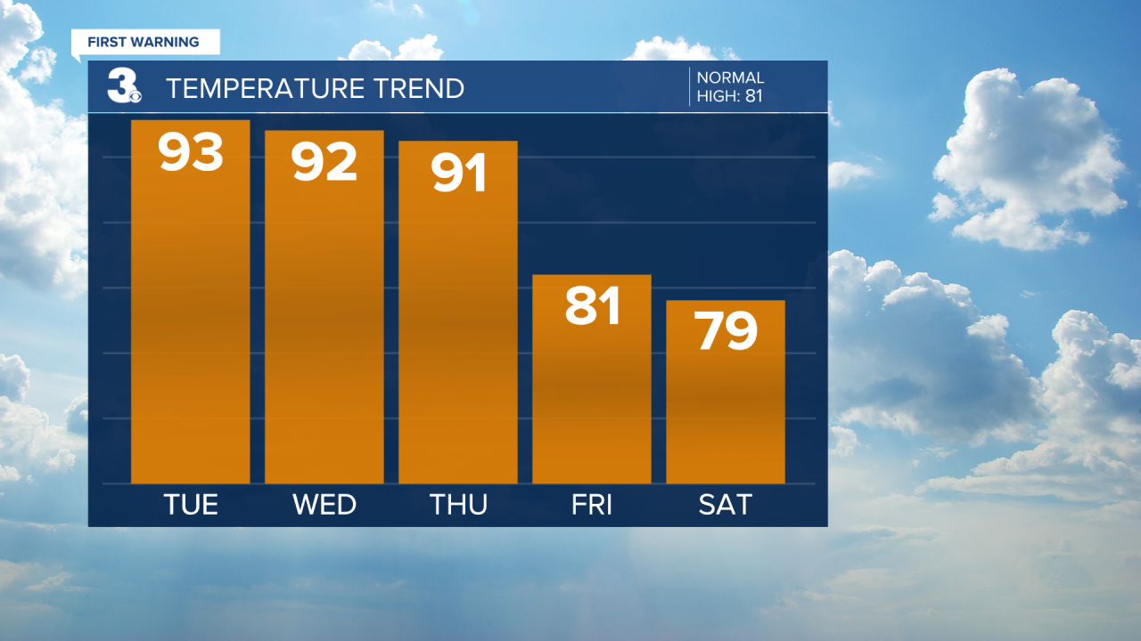
The hot weather will continue into Wednesday as highs once again soar to the low 90s. We could see a spotty storm pop-up, but keeping chances low.
A cold front will approach on Thursday and move through Thursday night and Friday. This will bring the chance for showers and storms by Thursday evening. Before the cold front moves through, temperatures will soar to the 90s once again. Severe storms will be possible, especially for Virginia Most of the area is under a level 1 for severe storms, minus Accomack County which is under a level 2. The biggest threat will be damaging wind gusts.

Scattered showers and storms will be possible on Friday with drier air moving in by Friday night and the weekend. It will be about ten degrees cooler with highs in the low 80s.
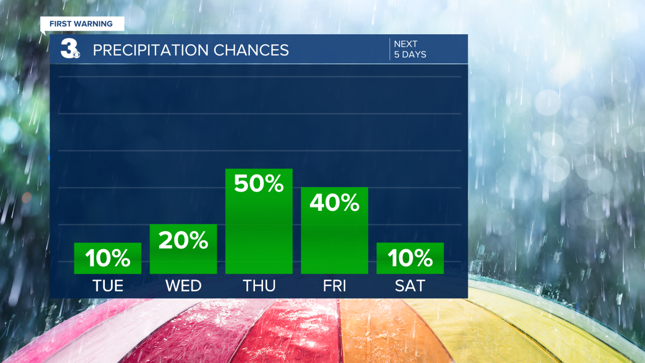
Looking like a gorgeous weekend on tap with highs in the upper 70s and low 80s with lower humidity.
Dry and comfortable to kick off the work week. High temperatures will warm to the low 80s.
Meteorologist April Loveland
For weather updates on Facebook: HERE
Follow me on Twitter: HERE
Follow me on Instagram HERE
Check out the Interactive Radar on WTKR.com: Interactive Radar
