


Meteorologist April Loveland's First Warning Forecast
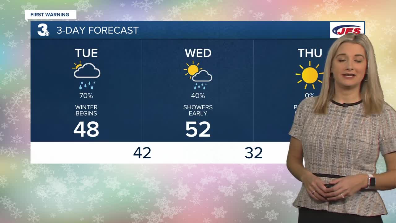
It's the First Day of Winter! Winter arrives at 10:59 AM. More clouds are building in this morning ahead of an area of low pressure. Rain chances will increase as the day progresses, with showers reaching North Carolina by lunchtime. Wet weather will continue to spread across the area this afternoon and evening. Temperatures will warm upper 40s to low 50s along the coast.
Showers will continue overnight and early Wednesday morning, but should move out after sunrise Wednesday. Clouds will decrease through the day with highs in the low 50s. Colder air will move in Wednesday night with lows in the upper 20s and low 30s. A cold front will move through Saturday night, but it's looking dry. Just a small drop in temperatures on Sunday with highs in the mid 50s.
A cold and sunny Thursday with highs in the mid 40s and wind chills in the 30s.
A warming trend begins on Christmas Eve with highs in the mid 50s. Even warmer on Christmas Day with highs in the mid 60s!
Keeping a slight chance for showers on Monday.
Meteorologist April Loveland
For weather updates on Facebook: HERE
Follow me on Twitter: HERE
Follow me on Instagram HERE
Check out the Interactive Radar on WTKR.com: Interactive Radar
