


Meteorologist Kristy Steward's First Warning Forecast
Good Friday night! It has been an active afternoon-early night with mean storms rolling through and even some tornado warnings. Now our severe threat is over, but we’ll still have more rounds of rain and storms this weekend into much of next week.
Some lingering showers are possible overnight, but the bulk of the storms are gone. We stay cloudy overnight and warm with lows in the mid to upper 60s.
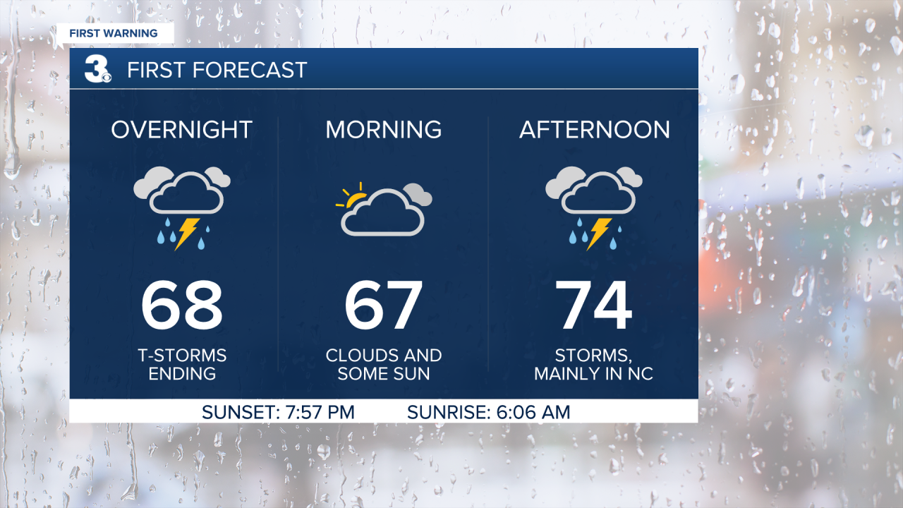
Saturday will be comfortable in the mid 70s. The day starts off dry, but scattered showers return in the afternoon. Scattered storms mainly stay confined to NC in the evening hours.
The low pressure system that tracks through Hampton Roads Saturday will park itself just offshore throughout most of next week. This will bring us wet, windy and cool weather along with tidal flooding and a rough surf.
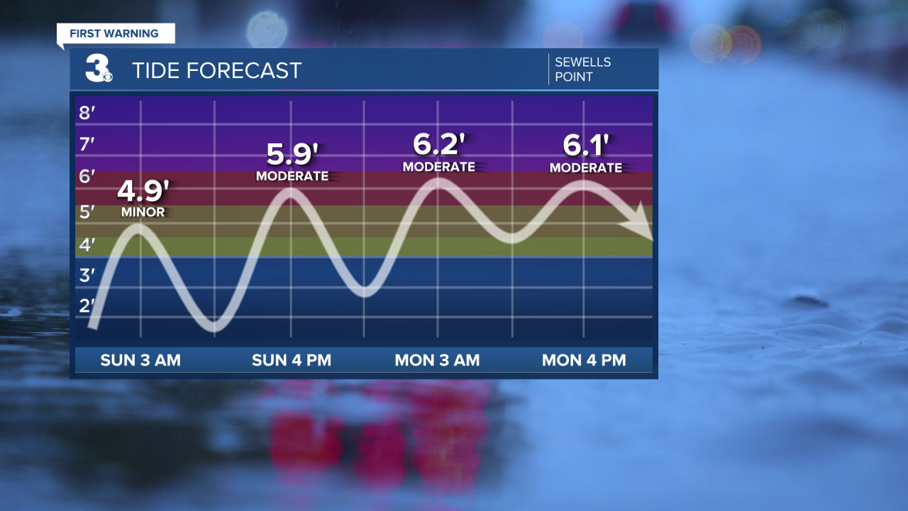
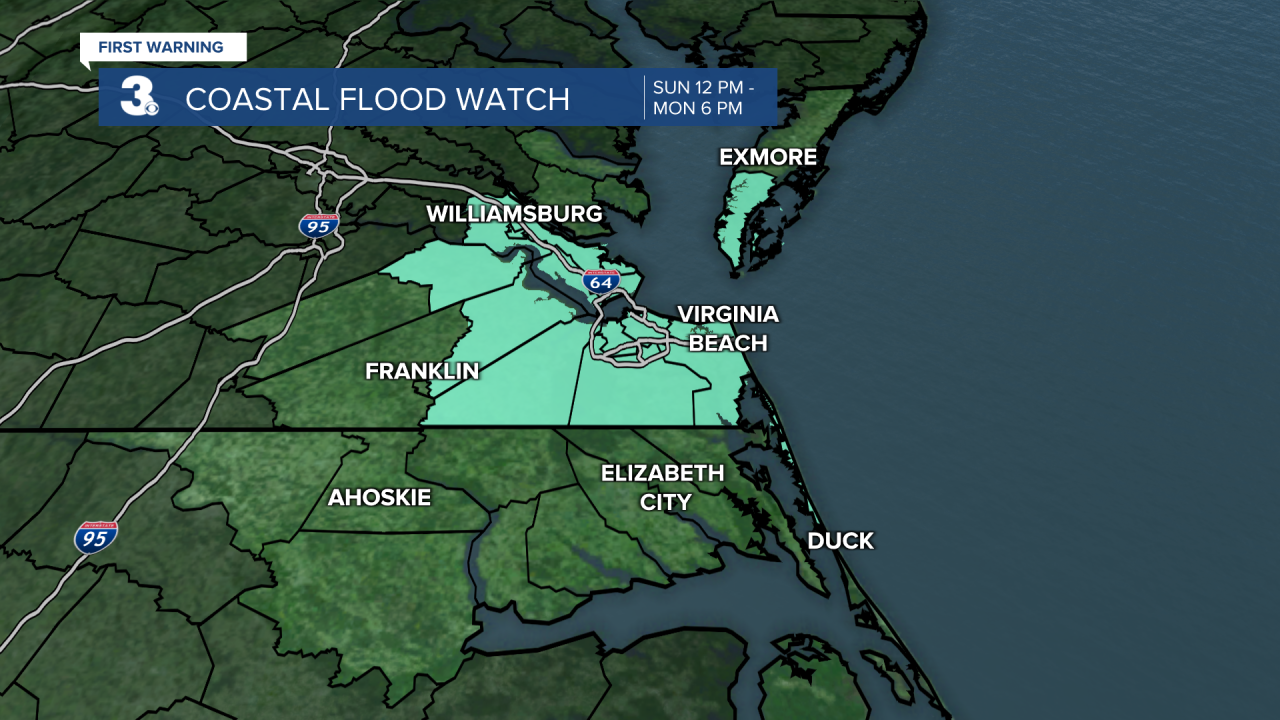
Expect moderate tidal flooding with around 3’ inundation during high tide Sunday afternoon and throughout the day Monday. We already have a Coastal Flood Watch in effect Sunday 12 PM - Monday 6 PM.
In the Chesapeake Bay, there will be 1-2’ waves Saturday, 4-6’ waves Sunday, and 4-5’ waves Monday. In the Atlantic, waves will be 3-5’ Saturday, 9-11’ Sunday, and 9-13’ Monday.
Mother’s Day will be cool, windy and wet. Highs in the upper 50s. Scattered lighter rain showers throughout the day. Isolated showers, windy and still cool around 60° Monday and Tuesday. We should catch a drier break Wednesday and see a little more sunshine that will help kick off a warming trend. Highs Wednesday in the mid 60s rise to the low 70s for the end of the workweek. More isolated to scattered showers and clouds Thursday and Friday.
Connect with Meteorologist Kristy Steward:
