


Meteorologist April Loveland's First Warning Forecast
A storm system that is expected to bring an outbreak of severe thunderstorms to the mid-south to the Gulf Coast later today and tonight is headed in our direction. The system will lose some of its punch, but strong to severe storms will still be possible across our area on Thursday.


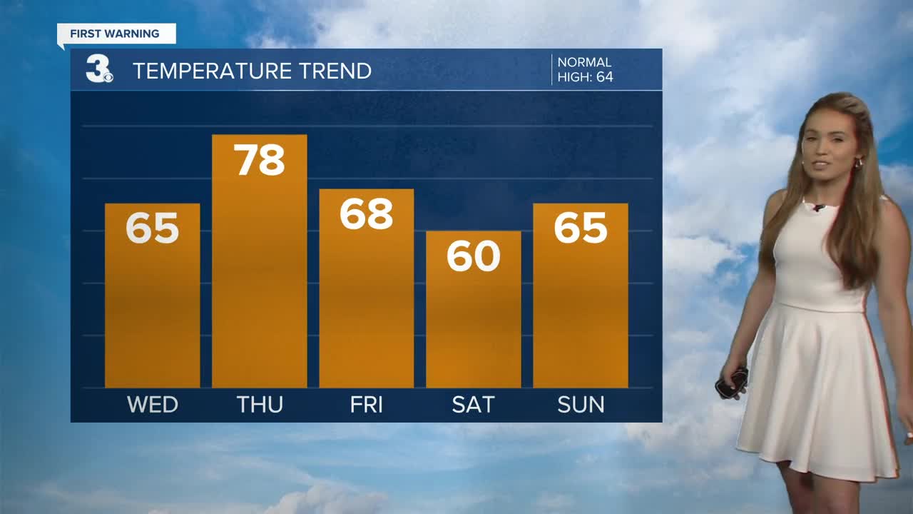
Partly cloudy and milder today with highs in the mid 60s.
The warm up will continue on Thursday. Highs will warm to the mid and upper 70s, but a cold front will bring the chance for strong to severe storms. Timing will be after 4 PM to about midnight. The biggest threat will be damaging wind gusts, heavy rain, and hail. With all severe storms, an isolated tornado cannot be ruled out. Winds could gust 40-60 mph with some of the stronger storms. It will be on the windy side all day with winds out of the southwest 15-25 mph, with gusts up to 40 mph.

Clearing skies and breezy conditions to end the work week. Temperatures will be about 10 degrees cooler with highs in the upper 60s.
Partly cloudy on Saturday with highs in the upper 50s to near 60.
A few showers will be possible on Sunday with highs in the mid 60s.
Dry with sunshine to kick off the work week. Highs will be in the low and mid 60s. Even warmer on Tuesday, with highs warming to near 70.
Meteorologist April Loveland
For weather updates on Facebook: HERE
Follow me on Twitter: HERE
Follow me on Instagram HERE
Check out the Interactive Radar on WTKR.com: Interactive Radar
