


Meteorologist April Loveland's First Warning Forecast
Happy St. Patrick's Day!

More clouds will be around today, but it will be milder with highs in the upper 60s and low 70s. A spotty shower cannot be ruled out. If you're heading out to the marathon, it should be pretty good running weather. There will be a little bit of a breeze out of the west at 10-15 mph.

A cold front will move through tonight and into Monday. A spotty shower will be possible. This will bring another burst of cooler air. Expect partly cloudy skies and highs in the mid 50s.
Tuesday marks the First Day of Spring. Funny enough, it will also be the coolest day of the week with highs in the low and mid 50s. It will also be on the breezy side. Even though it will be cool to kick off Spring, at least it will be sunny!
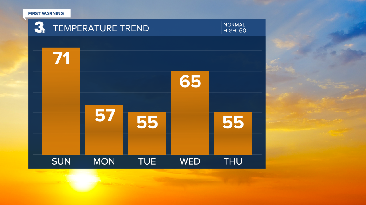
Temperatures will start trending warmer by midweek. Expect the sunshine to hang around with highs in the mid 60s. Skies will turn partly cloudy on Thursday with highs in the mid 50s.

Showers will move in for Friday afternoon. Highs will be in the upper 50s. Scattered showers will continue on Saturday with highs in the upper 50s.

Meteorologist April Loveland
For weather updates on Facebook: HERE
Follow me on Twitter: HERE
Follow me on Instagram HERE
Check out the Interactive Radar on WTKR.com: Interactive Radar
