


Meteorologist April Loveland's First Warning Forecast
We're 33 days away from the first day of Spring, but we're not going to have to wait much longer to start feeling spring-like. Highs in the 60s and 70s on the way, along with when you'll need to break out the umbrella.
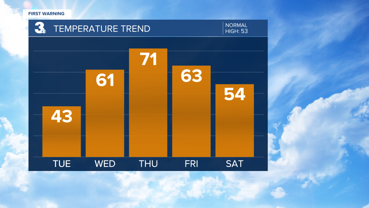
Chilly again today with highs in the low 40s under mostly sunny skies. Skies will be clear overnight, but it won't be quite as frigid. Expect lows in the upper 20s and low 30s.
A nice warm up by Wednesday. Winds will turn to the south and usher in much warmer air. Expect highs in the low 60s.
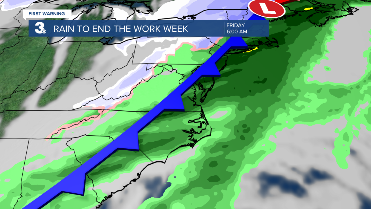
It's about to get windy! A strong cold front will approach on Thursday and winds will pick up out of the south ahead of the front. Wind gusts up to 30 mph will be possible. The southerly wind will help to boost our temperatures to the low 70s. This is well-above normal for this time of year. Rain will move in late. Showers will continue overnight and into the first half of the day Friday. Temperatures will start out in the 60s Friday morning, and fall as the day progresses and the cold front moves through. Expect temperatures in the 40s by the afternoon.
The weekend is shaping up to be dry with near-normal high temperatures in the low and mid 50s. Skies will be mostly sunny.
Another warm up for Presidents Day with highs in the mid 60s.
Meteorologist April Loveland
For weather updates on Facebook: HERE
Follow me on Twitter: HERE
Follow me on Instagram HERE
Check out the Interactive Radar on WTKR.com: Interactive Radar
