


Meteorologist April Loveland's First Warning Forecast
A soggy afternoon and evening ahead.
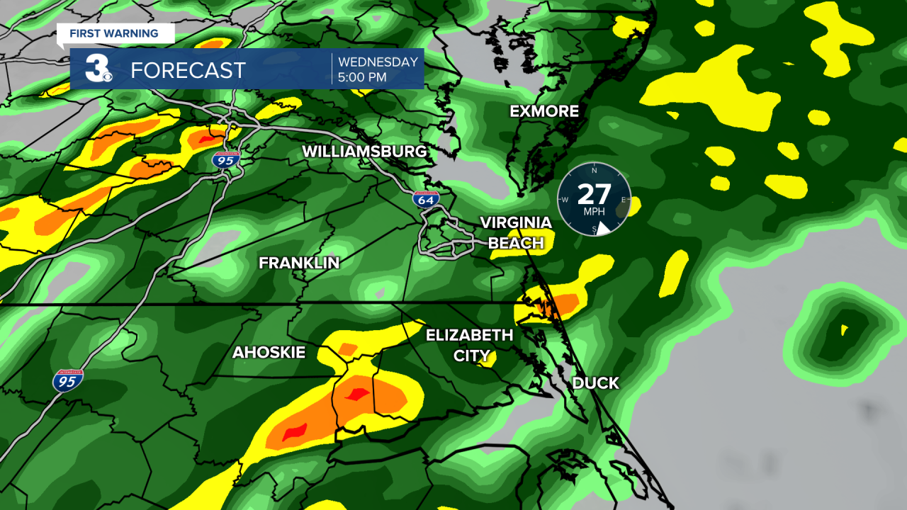
A big storm system will move in today. This will bring rain, wind and storms to the area. A portion of the area is under a level one for severe storms, which means an isolated severe storm is possible. The biggest threat will be damaging wind gusts and an isolated tornado. Winds could gust up to 40 mph in non severe storms. It will also be our mildest day of the week with highs in the low 60s.


The wind will stick around through Thursday with highs in the low 50s with more sunshine breaking out.
Friday will feature wall to wall sunshine, but it will be the coldest day of the week with highs only in the upper 40s.
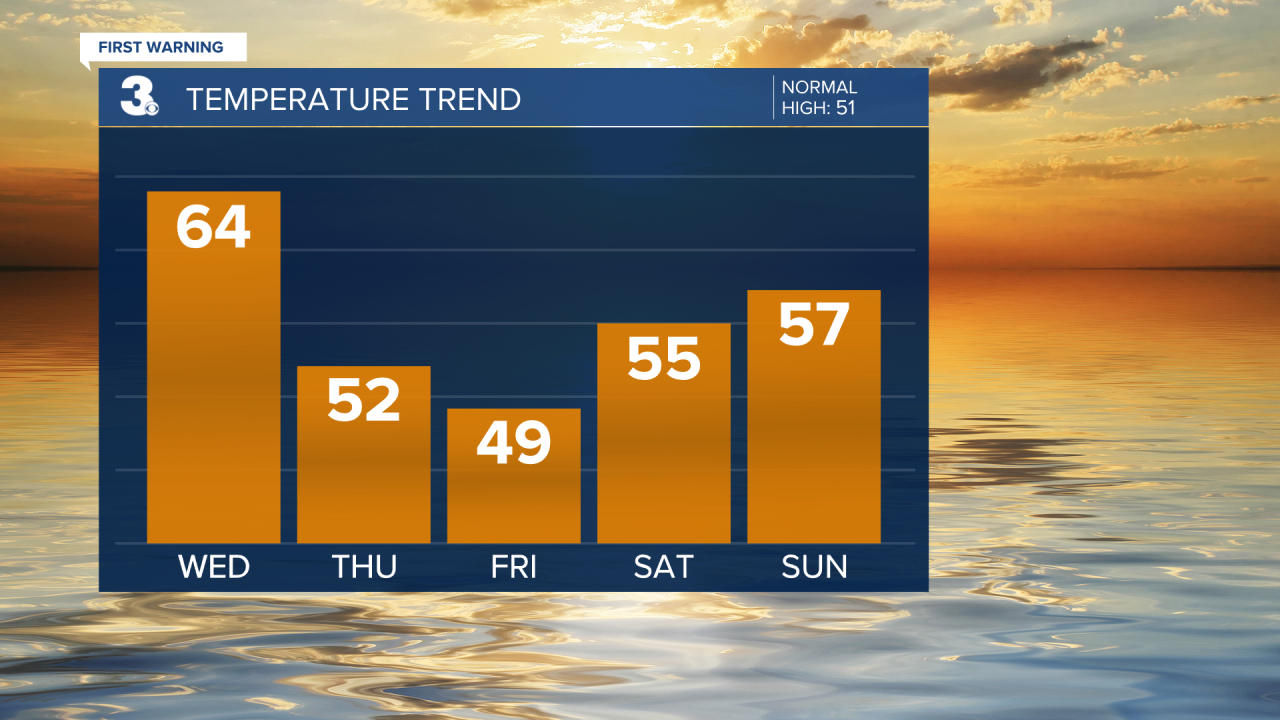
The weekend looks like it's shaping up to be nice. We will have lots of sunshine on Saturday with highs in the mid 50s. A few more clouds will build in on Sunday, with highs in the mid 50s.
Rain chances will increase on Monday and Tuesday. Expect the chance for scattered showers both days. Highs will reach the low and mid 50s.
Meteorologist April Loveland
For weather updates on Facebook: HERE
Follow me on Twitter: HERE
Follow me on Instagram HERE
Check out the Interactive Radar on WTKR.com: Interactive Radar
