


Meteorologist April Loveland's First Warning Forecast
**HEAT ADVISORY in effect 11 AM until 6 PM. Heat Index values from 105-108 degrees possible.
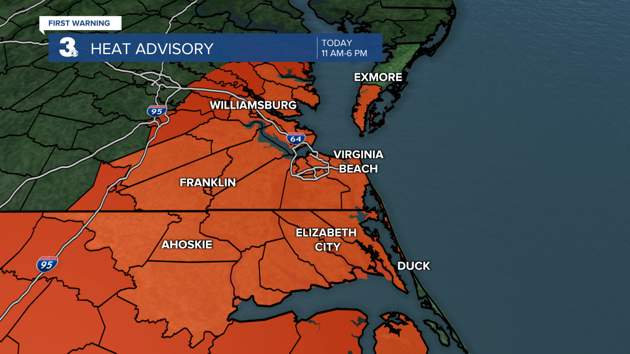

Tracking another day of dangerous a heat. Highs will soar to the low and mid 90s with heat index values up to 110 degrees possible. We'll start with sunshine with clouds building in as the day progresses ahead of a cold front. A cold front will approach from the northwest and move into the area tonight. Showers and storms will 'pop-up' ahead of this front by the late afternoon and evening hours. The area is under a level 1 for severe storms. The biggest threat will be damaging wind gusts, hail and frequent lightning. Along with that, heavy downpours will be possible which could lead to flooding in flow-moving storms. Most of our Virginia viewing area is under a flash flood threat. Showers and storms will start to wane overnight with lows in the low and mid 70s.
The front will stall near the Virginia and North Carolina border on Sunday. This will make for an unsettled stretch of weather. Rounds of showers and storms will be possible during the day. Flash flooding will be possible for the entire area. One of the big differences will be the temperatures. Temperatures will fall into the low and mid 80s bringing much needed relief from several days in the 90s.
Rounds of showers and storms will continue to be possible on Monday with highs in the low and mid 80s. Localized flooding will once again be a concern.
Not as wet on Tuesday and temperatures will begin to warm to the mid 80s. Still keeping a chance for a few showers and storms.
The unsettled weather will continue into the end of the week with a lot of moisture available due to the atmospheric setup. We could even see some moisture from Tropical Depression Fred. Temperatures will continue to trend in the 80s.
Keep the umbrella handy this week!
Tropical Update:
Tropical Depression Fred
Fred continues to be poorly organized and is located about 25 miles west of Havana Cuba.
The depression is moving toward the west-northwest near 13 mph and this motion is expected to continue today. A turn to the northwest is expected by tonight, followed by a northward motion by Sunday night. On the forecast track, Fred is expected to pass west of the lower Florida Keys this afternoon, move across the eastern Gulf of Mexico tonight through Monday, and move inland over the northern Gulf coast Monday night.
Maximum sustained winds remain near 35 mph with higher gusts. Slow strengthening is forecast, and Fred could become a tropical storm again tonight or on Sunday.

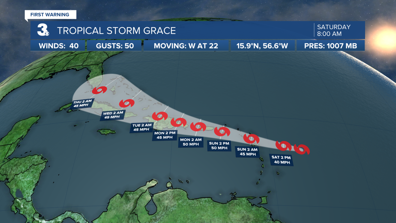
Tropical Storm Grace
Grace is moving quickly westward toward the Leeward Islands.
Located about 355 miles ESE of the Leeward Islands.
Grace is moving toward the west near 22 mph. A motion toward the west with a gradual decrease in forward speed is expected during the next few days. On the forecast track, the center of the storm is forecast to move over the Leeward Islands tonight, over the Virgin Islands and Puerto Rico on Sunday, and then over the Dominican Republic on Monday.
Maximum sustained winds are near 40 mph with higher gusts. Some strengthening is forecast during the next couple of days. Weakening is expected early next week as the system interacts with the Greater Antilles. Grace is a small tropical storm. Tropical-storm-force winds extend outward up to 25 miles from the center.
Meteorologist April Loveland
For weather updates on Facebook: HERE
Follow me on Twitter: HERE
Follow me on Instagram HERE
Check out the Interactive Radar on WTKR.com: Interactive Radar
