


Meteorologist April Loveland's First Warning Forecast
The warm up continues!
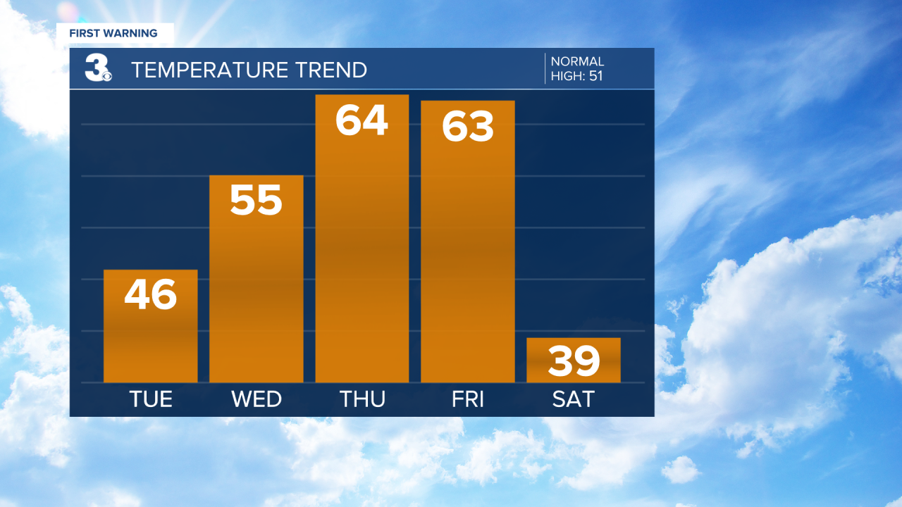
Temperatures will continue to warm through the end of the week and rain chances will be on the rise. Expect highs in the 40s to near 50 today under mostly sunny skies. Very comfortable day for the first of February.
A few more clouds will be around on Wednesday, which is also Groundhog Day. It will be dry with highs in the mid 50s.
Thursday will be the warmest day of the week. Temperatures will soar into the low 60s. A few spotty showers will be possible. Other than that, not looking too bad. Especially with those spring-like temperatures!
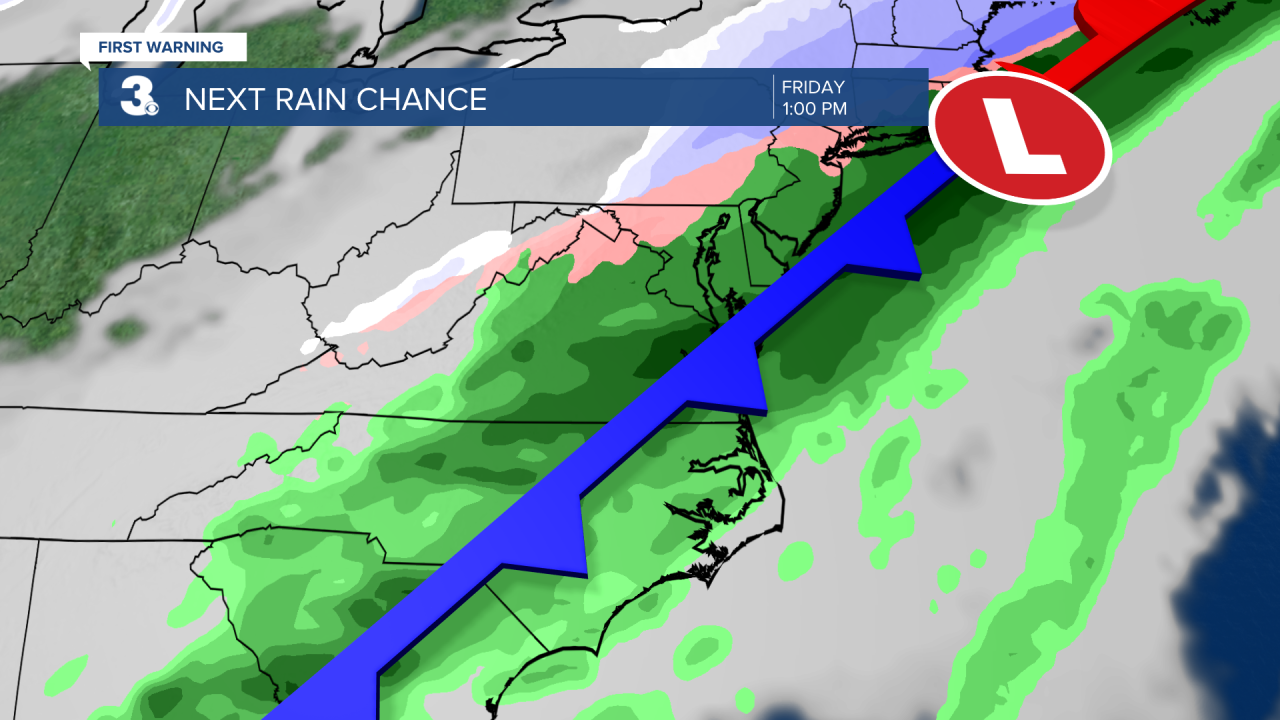
Our next big weather maker moves in just in time to end the work week. Expect rain and wind on Friday. It will still be mild with highs in the low 60s. This is the same system that will bring snow and ice to the Midwest. It will mainly just be a rainmaker for us. Although we could see a brief changeover to sleet and snow as the system exits early Saturday morning.
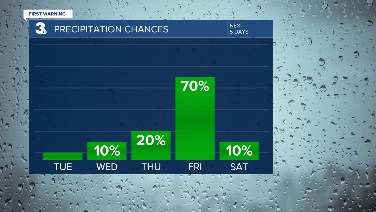
If you're heading out to the Polar Plunge on Saturday, the temperatures will also be taking a plunge. Highs will only warm to the upper 30s, but it's looking dry. There will still be a bit of a breeze making temperatures feel like the 20s.
Precipitation chances will increase on Sunday and Monday, with a chance for a mix of rain, sleet and snow. Some forecast models are even hinting at another chance for snow late Monday and Tuesday. Stay tuned!
Meteorologist April Loveland
For weather updates on Facebook: HERE
Follow me on Twitter: HERE
Follow me on Instagram HERE
Check out the Interactive Radar on WTKR.com: Interactive Radar
