


Meteorologist April Loveland's First Warning Forecast
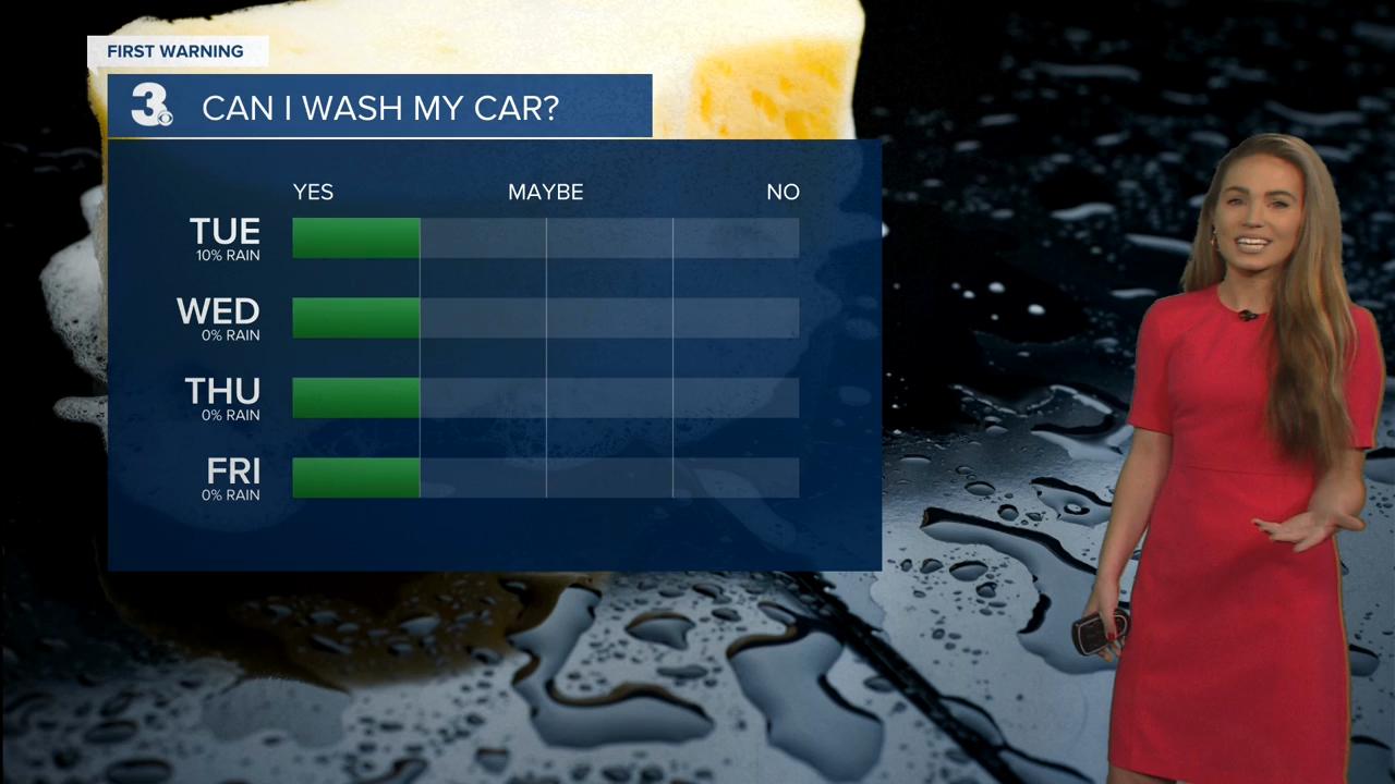
Dry today, but still a little on the gloomy side. Clouds will break up a bit as the day progresses. Expect highs in the upper 40s.
We'll enter a quiet weather pattern for the rest of the week. Temperatures will continue to gradually warm as the week progresses. The normal high in Norfolk is now 52 degrees. Expect temperatures to be above normal for the remainder of the week.
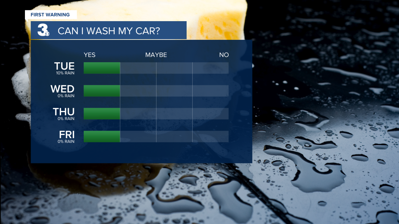
Dry with wall-to-wall sunshine on Wednesday. Highs will warm to the mid 50s.
We'll then warm to the upper 50s on Thursday and Friday under mostly sunny skies.
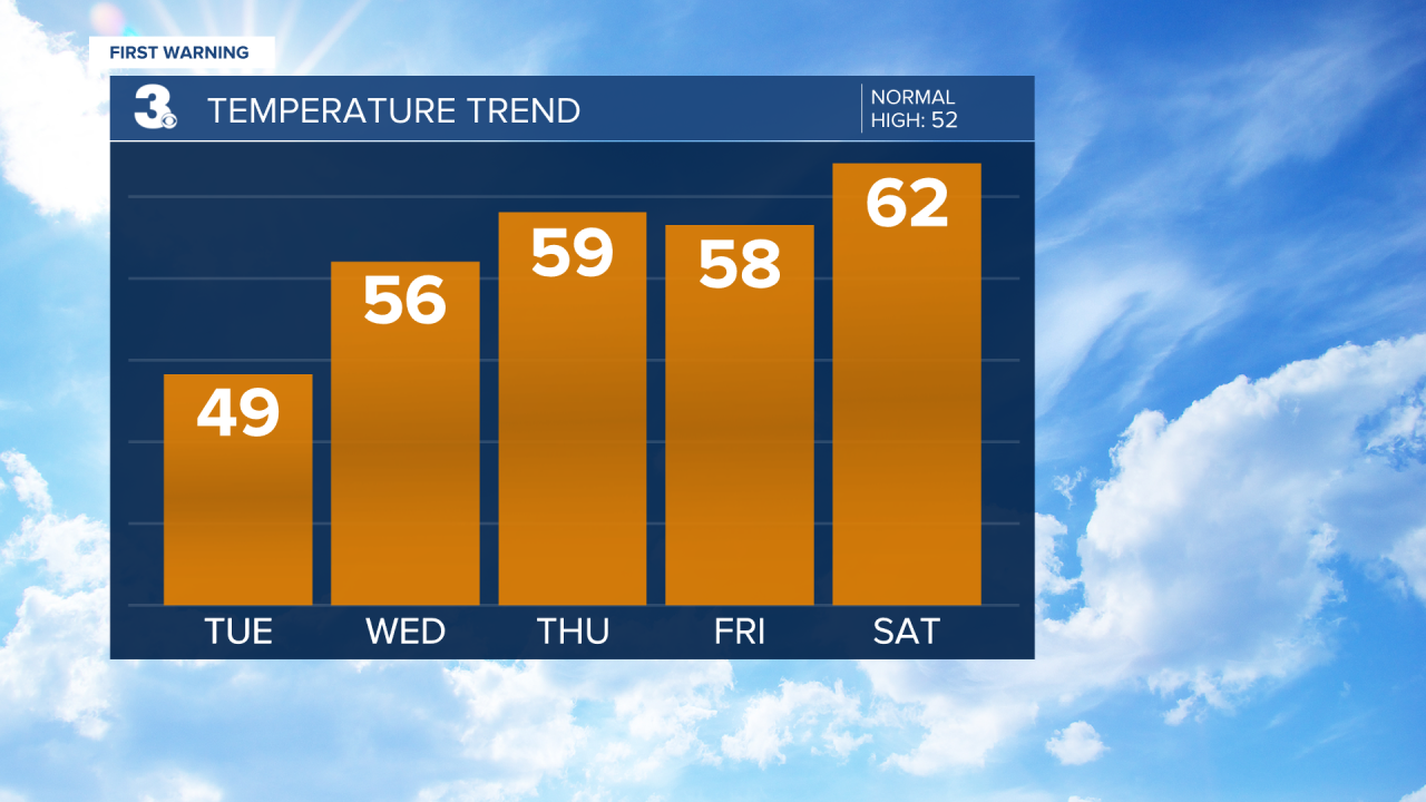
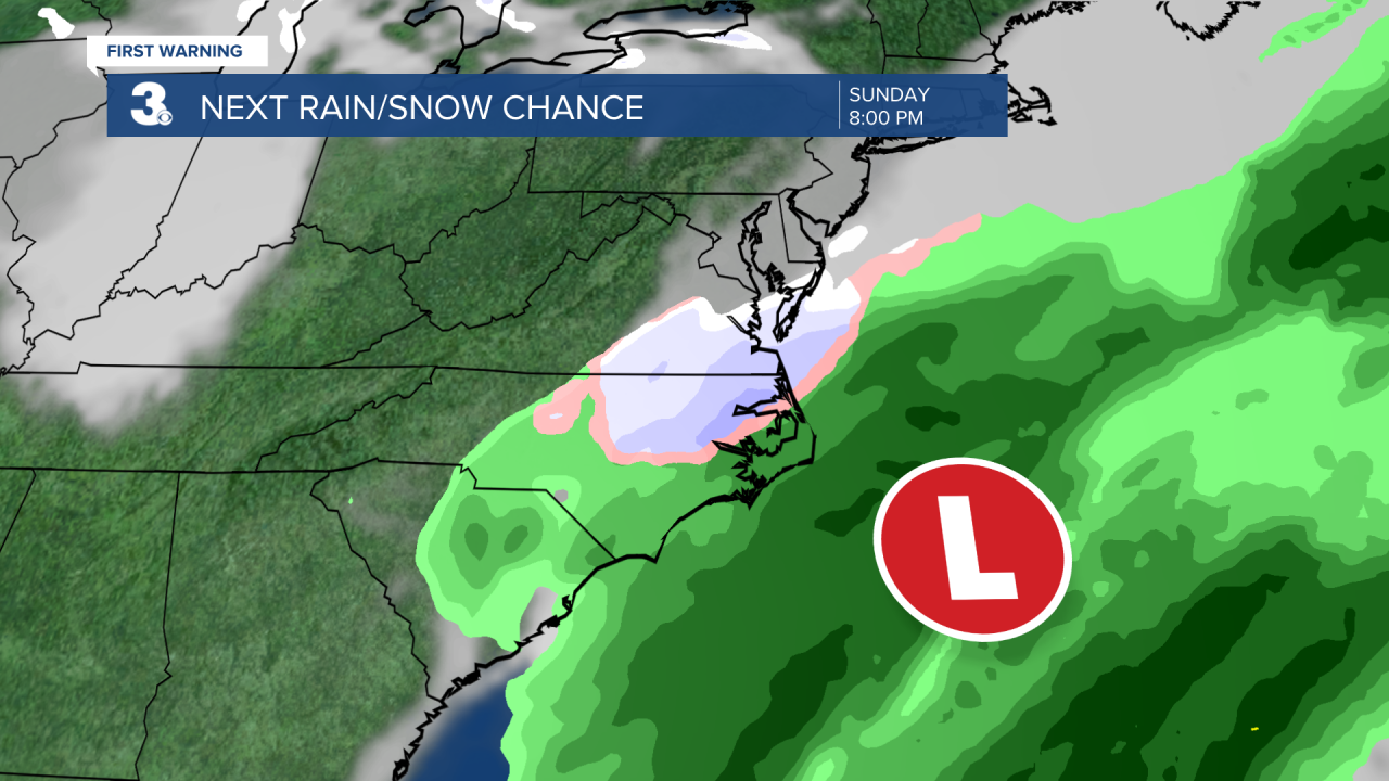
The weekend will be 50/50. Saturday will feature sunshine and highs in the low 60s. Our attention turns to the next weather maker on Sunday. This system could bring us the chance for rain and snow. Still too early to tell, but STAY TUNED!
Meteorologist April Loveland
For weather updates on Facebook: HERE
Follow me on Twitter: HERE
Follow me on Instagram HERE
Check out the Interactive Radar on WTKR.com: Interactive Radar
