


Meteorologist April Loveland's First Warning Forecast
** Red Flag Warning from 2 PM to 8 PM today for parts of inland Northeast North Carolina. A Red Flag Warning means that critical fire weather conditions are expected, including strong winds and low humidity.
** Freeze Warning from 3 AM to 9 AM Tuesday for mainland Dare County.
** Freeze Watch from 3 AM to 9 AM Tuesday for parts of the Outer Banks of Dare County (north of Oregon Inlet).
Below-normal, but dry over the next few days. Warming up and tracking storms by the end of the week.
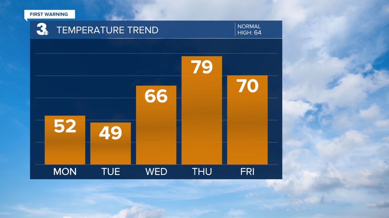
Dry and cold today with highs in the low 50s. A few flurries are possible along the Eastern Shore, but won't be a big deal. The gusty winds, dry vegetation and low relative humidity, will lead to increased fire danger today. Remember, open burning is prohibited in Virginia through April 30th.
Skies will be mostly clear overnight and temperatures will plummet into the mid and upper 20s. Many areas will get a hard freeze overnight, and you may have to scrape your windshields early Tuesday. The record low for Norfolk is 25 degrees, set in 1982. Clouds will build in as the day goes on. Expect highs in the upper 40s to near 50.
More clouds will be around on Wednesday, but it will be warmer with highs in the mid 60s.
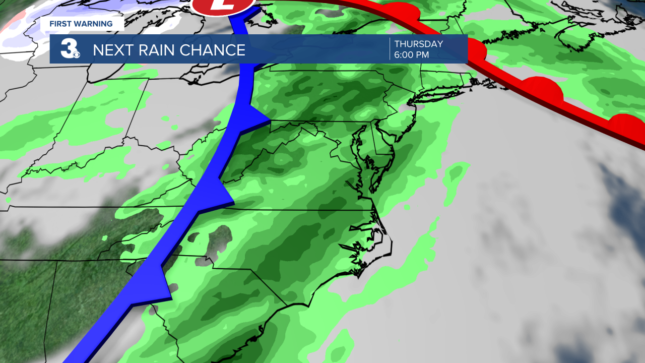
A cold front will cross on Thursday. This will bring rain and storms to the area. It will also be the warmest day of the week with highs near the 80 degree mark.
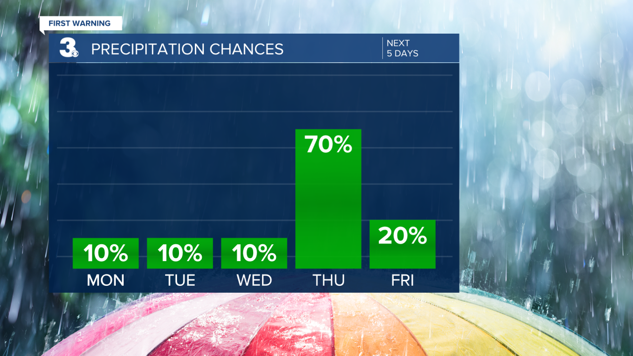
A few lingering showers will be possible on Friday, otherwise skies will be partly cloudy with highs near 70.
More sunshine will break out on Saturday with highs in the low and mid 60s. Scattered showers will be possible on Sunday, with highs in the low 60s.
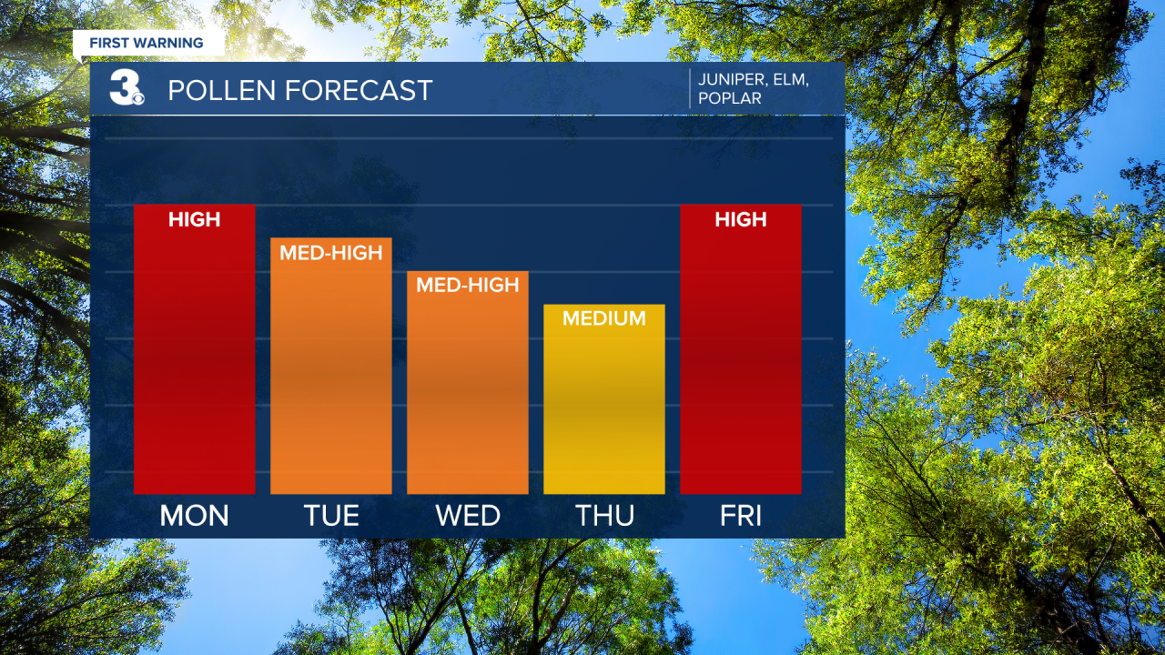
Check out your Pollen Forecast:
Meteorologist April Loveland
For weather updates on Facebook: HERE
Follow me on Twitter: HERE
Follow me on Instagram HERE
Check out the Interactive Radar on WTKR.com: Interactive Radar
