


Meteorologist Kristy Steward's First Warning Forecast
Good Wednesday night! Deja Vu – Tomorrow is another Thursday with yet another severe threat... Our fourth one in a row!
We have a strong cold front heading our way Thursday. Well ahead of it, we stay dry and partly cloudy tonight, but southerly winds start to pick up to 15-20 MPH and that keeps us warm overnight. Lows in the mid 60s.
Clouds increase throughout Thursday morning. Majority of the day looks dry, up until that evening commute. Scattered storms begin moving into Hampton Roads around 6 PM Thursday and continue until 6 AM Friday. The greatest severe threat will be throughout Thursday evening at the front of this line.
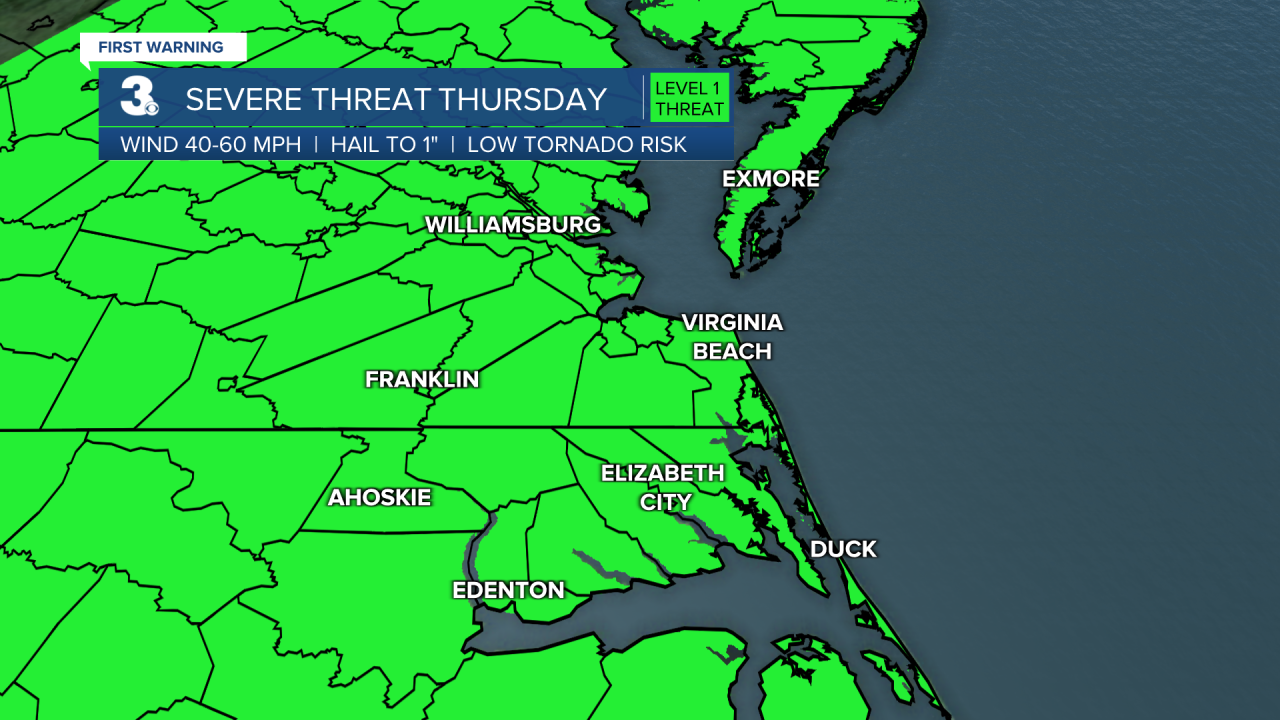
Everyone is under a Level 1 out of 5 risk for severe weather. In isolated strong to severe cells, our concerns are damaging wind gusts, heavy downpours, and pockets of isolated large hail.

Behind this powerful cold front, temperatures cool into the mid 50s Friday morning. Friday afternoon we’ll see lots of sunshine and temperatures in the upper 60s.
Ahead of another cold front, temperatures return to the mid 70s Saturday. Spotty showers will be possible Saturday afternoon and evening ahead of the front. We get breezy Saturday and stay breezy into next week as we move into an unsettled weather pattern.
Easter Sunday looks nice. Mostly dry with a mix of sun and clouds. It will be a cooler day. Temperatures around sunrise in the mid 50s will only warm a handful of degrees into the low 60s by Sunday afternoon. Overall, a nice Easter this year!

Scattered rain showers kick off the workweek Monday into Tuesday morning. Temperatures stay cooler in the low to mid 60s for at least the first half of the week.
High pressure starts to settle in Wednesday. That will bring us tons of sunshine and keep us dry.
Connect with Meteorologist Kristy Steward:
