


Meteorologist April Loveland's First Warning Forecast
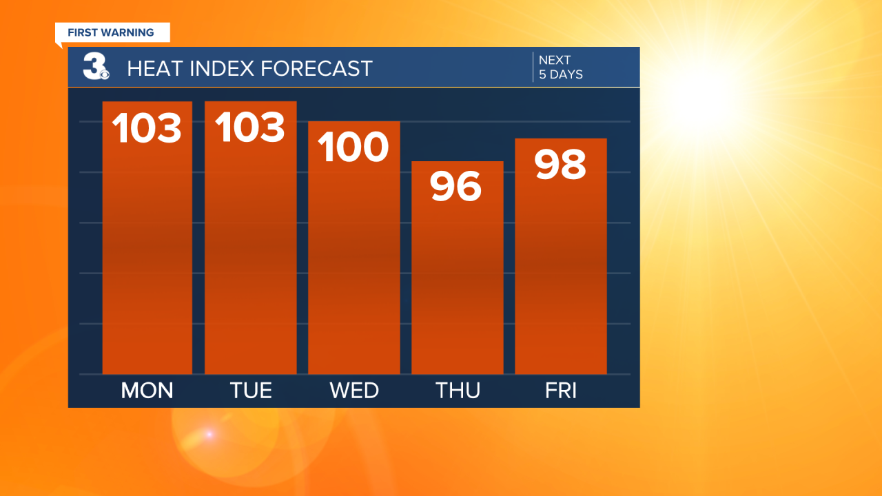
Hot and muggy to kickoff the work week. Highs will soar to the low and mid 90s with heat index values of 100-105. Conditions will be mostly dry with sunshine as high pressure takes over the area. We'll continue to keep a slight chance for a stray shower or storm in the afternoon, but nothing major. Keeping it around a 20 percent chance.
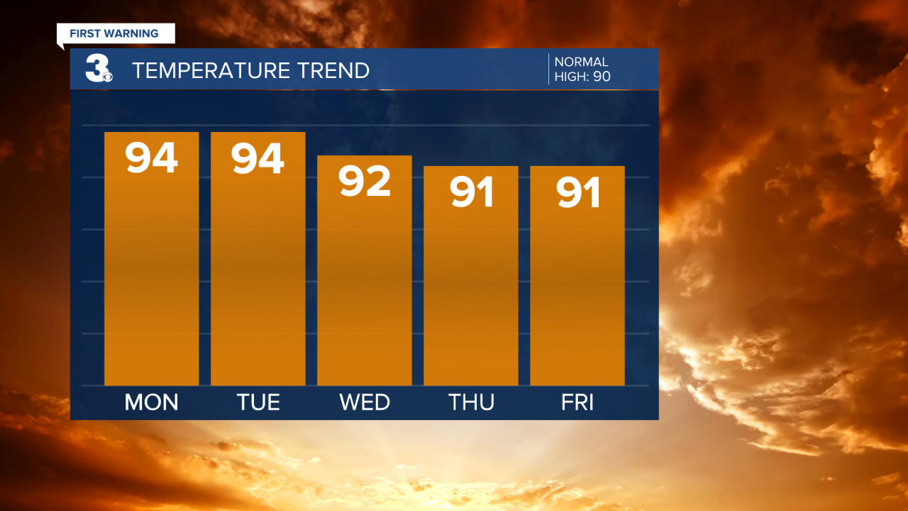
Basically the same story heading into Tuesday and Wednesday. Hot and humid with highs in the low and mid 90s.
A little bit better chance to see a few afternoon storms by Thursday as high pressure weakens over the area. Temperatures will continue to trend in the low 90s. A spotty shower or storm will be possible to end the work week. Again, it will be a slight 20 percent chance. Better chances to see some afternoon showers and storms by the weekend. Highs will warm to 90 on Saturday and we should slip into the upper 80s on Sunday.
Weather & Health
Pollen: Low-Medium (Grasses)
UV Index: 10 (Very High)
Air Quality: Good (Code Green)
Mosquitoes: Very High
Tropical Update:
No Activity expected over the next 2 days
Meteorologist April Loveland
For weather updates on Facebook: HERE
Follow me on Twitter: HERE
Follow me on Instagram HERE
Check out the Interactive Radar on WTKR.com: Interactive Radar
