


Meteorologist April Loveland's First Warning Forecast
Tracking a stormy week and up and down temperatures.
There is a big temperature spread out there today. Temperatures are ranging from the upper 50s north to the upper 80s in North Carolina.

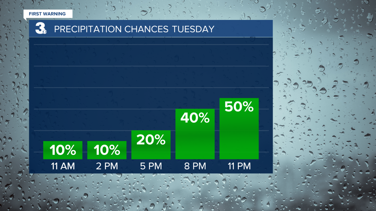
We've also been dealing with areas of fog, especially along the coast. Showers and storms will move in tonight. Storms could become strong to severe. The biggest threat will be damaging wind gusts, hail and heavy rain.

We're tracking another round of showers and storms on Wednesday, so keep the rain gear handy!

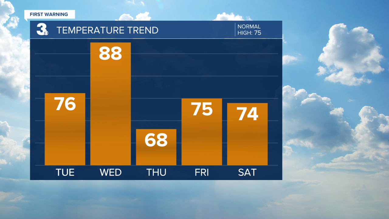
Temperatures will be all over the place for the rest of the week. Highs will soar to the upper 80s and some folks may even break into the 90s! Then temperatures will take a tumble on Thursday with highs only reaching the upper 60s. That's a 20 degree temperature difference!
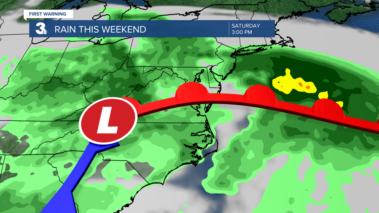
Thursday is looking mostly dry and cool, but more rain will roll in just in time to end the work week and into Mother's Day weekend. Make sure you have your indoor plans along with the outdoor!
Meteorologist April Loveland
For weather updates on Facebook: HERE
Follow me on Twitter: HERE
Follow me on Instagram HERE
Check out the Interactive Radar on WTKR.com: Interactive Radar
