


Meteorologist April Loveland's First Warning Forecast

Strong to severe storms, then a cool down.
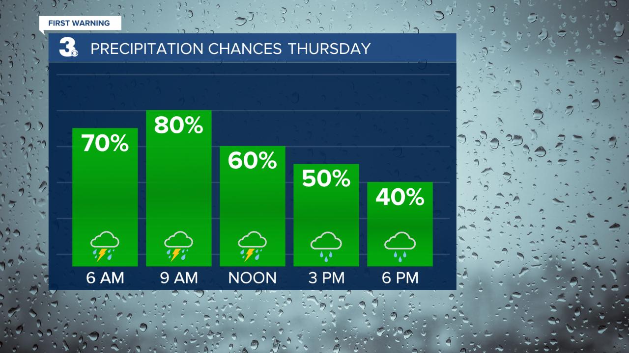
We have a bit of a temperature spread this afternoon with cooler temperatures in the 50s to the north and 70s to the south in North Carolina. Clouds continue to roll in ahead of our next storm system. Showers and storms will be possible later this evening, overnight and Thursday. Most of the area is under a level 1 for severe storms today and the entire area is under a level 1 for severe storms on Thursday. This means that isolated severe storms will be possible. The biggest threats will be damaging wind gusts and heavy rain. An isolated tornado cannot be ruled out. There will be a lot of moisture available and these storms will be slow movers. We will want to watch out for localized flooding overnight and Thursday. Everything looks to exit the area after 7 PM on Thursday. We will continue to keep an eye on the timing. Temperatures will warm to the low 70s.


Partly cloudy to end the work week. Temperatures will be in the mid 60s.
The cooling trend will continue into the weekend. A few spotty showers will be possible on Saturday with highs in the low 60s. Cooler and windy on Sunday with highs only reaching the mid 50s which is below-normal for this time of year.

The dry weather will carry into the start of the work week. Another cool, but sunny day on Monday with highs in the upper 50s. Warming to near 60 on Tuesday under partly cloudy skies.
