


Meteorologist April Loveland's First Warning Forecast
Feeling like 100 degrees today...Elsa on the way Thursday.
Hot and humid Wednesday on tap. Expect highs in the mid 90s. It will feel closer to 100 degrees once we factor in the humidity. Today will be the day to clear out any storm drains, secure patio furniture and kids toys because we are expect a wet and windy day Thursday as Tropical Storm Elsa moves in.
Mostly dry start Thursday. We'll start to see some of Elsa's outer rain bands by midday with widespread rain moving in during the afternoon and evening. A Tropical Storm Watch has been issued for most of the area. We'll continue with the chance for wind and rain overnight and Friday morning. Conditions will approve as the day progresses and Elsa pulls away. Temperatures will be much cooler due to all the clouds and rain. Expect highs in the low 80s.
Drier and warmer on Saturday with highs near 90. Expect a slight chance of scattered storms on Sunday with highs in the upper 80s.
Tropical Update
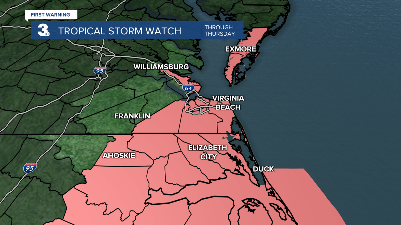
A Tropical Storm Watch is in effect from Little River Inlet, South Carolina to Chincoteague, Virginia including the Pamlico and Albemarle Sounds.
Center of Elsa making landfall in Taylor County along the North Florida Gulf Coast.
Located about 65 miles NNW of Cedar Key, Florida.
Max sustained winds of 65 mph, with higher gusts.
Elsa is moving toward the north near 14 mph, and a generally northward motion is expected to continue through this afternoon. A turn toward the north-northeast is expected late this afternoon or tonight, followed by a faster northeastward motion by late Thursday.
On the forecast track, Elsa will continue to move inland into Florida this afternoon. The storm should then move across the southeastern and mid-Atlantic United States through Thursday.
Weakening is expected as Elsa moves further inland this afternoon into tomorrow.
Tropical-storm-force winds extend outward up to 90 miles from the center.


Weather & Health
Pollen: Low-Medium (Grasses)
UV Index: 9 (Very High)
Air Quality: Good (Code Green)
Mosquitoes: Very High
Meteorologist April Loveland
For weather updates on Facebook: HERE
Follow me on Twitter: HERE
Follow me on Instagram HERE
Check out the Interactive Radar on WTKR.com: Interactive Radar
