


Meteorologist Kristy Steward's First Warning Forecast
Happy Sunday evening! We were a couple degrees hotter today. This gradual warming trend persists until the middle of the week. A very typical summertime pattern is in store for us with plenty of sunshine and PM pop-up storms.
The storms today lost their energy after the sun set, so we’ll stay dry and partly cloudy for tonight. Also, quite warm with lows in the mid 70s.
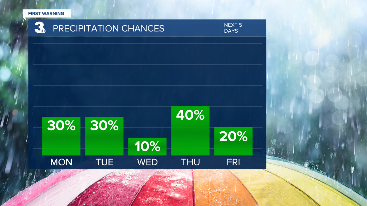
Temperatures climb a couple more degrees tomorrow to 92°. We’ll have plenty of sunshine and some showers around. In the morning, Dare county will likely have some lighter rain showers. By the afternoon and evening, everyone has a chance at seeing an isolated pop-up storm over them. Again, majority stay dry Monday, but a few storms here and there.
Similar weather Tuesday. Highs around 92° with isolated afternoon pop-ups.
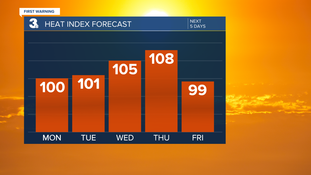
The heat is on for the middle of the week! Temperatures soar into the mid 90s Wednesday and Thursday, feeling like we’re around 105°-110°. Those will be the days to stay cool indoors in the A/C and drink tons of water! If you have to be outdoors, seek shade. Winds will be breezy Thursday, giving us a little relief from the high heat.
Wednesday stays dry, but an approaching cold front Thursday brings us scattered storms Thursday evening. This front looks to stall right over the top of Hampton Roads, bringing us spotty showers Friday and Saturday. It will also cool us down a few degrees into the lower 90s both days.
Temperatures return to the mid 90s Sunday. Breezy winds with isolated PM pop-up storms also return for Sunday.
Stay cool this week!
Connect with Meteorologist Kristy Steward:
