


Meteorologist April Loveland's First Warning Forecast
After a cool start, temperatures will soar to the upper 70s under mostly sunny skies. Winds will pick up out of the southwest during the afternoon and evening.

The work week as a whole is looking mainly dry and warm for this time of year.

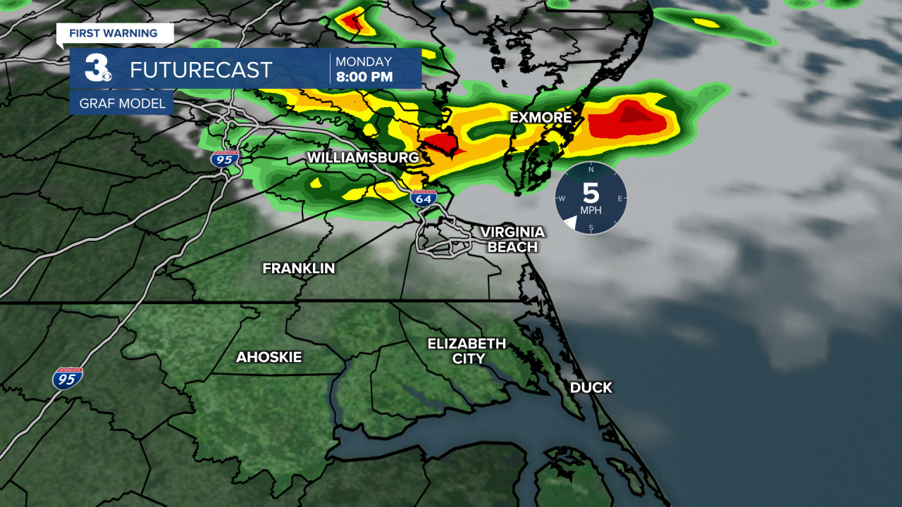
Temperatures will soar to the low 80s on Monday. Skies will be mostly sunny to start, with a few clouds building in during the afternoon. A cold front will slide through the area bringing a chance for isolated strong to severe storms by the evening hours. The biggest threat will be damaging wind gusts. Large hail will also be possible.

A spotty shower cannot be ruled out on Tuesday afternoon. Temperatures will also be cooler behind Monday's cold front with highs in the low 70s. Still really nice for this time of year.
More clouds will build in on Wednesday with highs warming to near 80 degrees.
We'll continue with a slight chance for a spotty shower on Thursday. It will be warm with highs in the low 80s.
Better chances for some showers by the afternoon on Friday. Temperatures will return to the low 70s.

Meteorologist April Loveland
For weather updates on Facebook: HERE
Follow me on Twitter: HERE
Follow me on Instagram HERE
Check out the Interactive Radar on WTKR.com: Interactive Radar
