


Meteorologist Kristy Steward's First Warning Forecast
Good Sunday night! We said a brief hello to Summer today! Highs in the mid to upper 80s for most of us, but a few locations even touched the low 90s. The last time we were this warm was September 15th!

We stay in the 80s to start the week, but a powerful cold front knocks us back into the 60s mid-week.
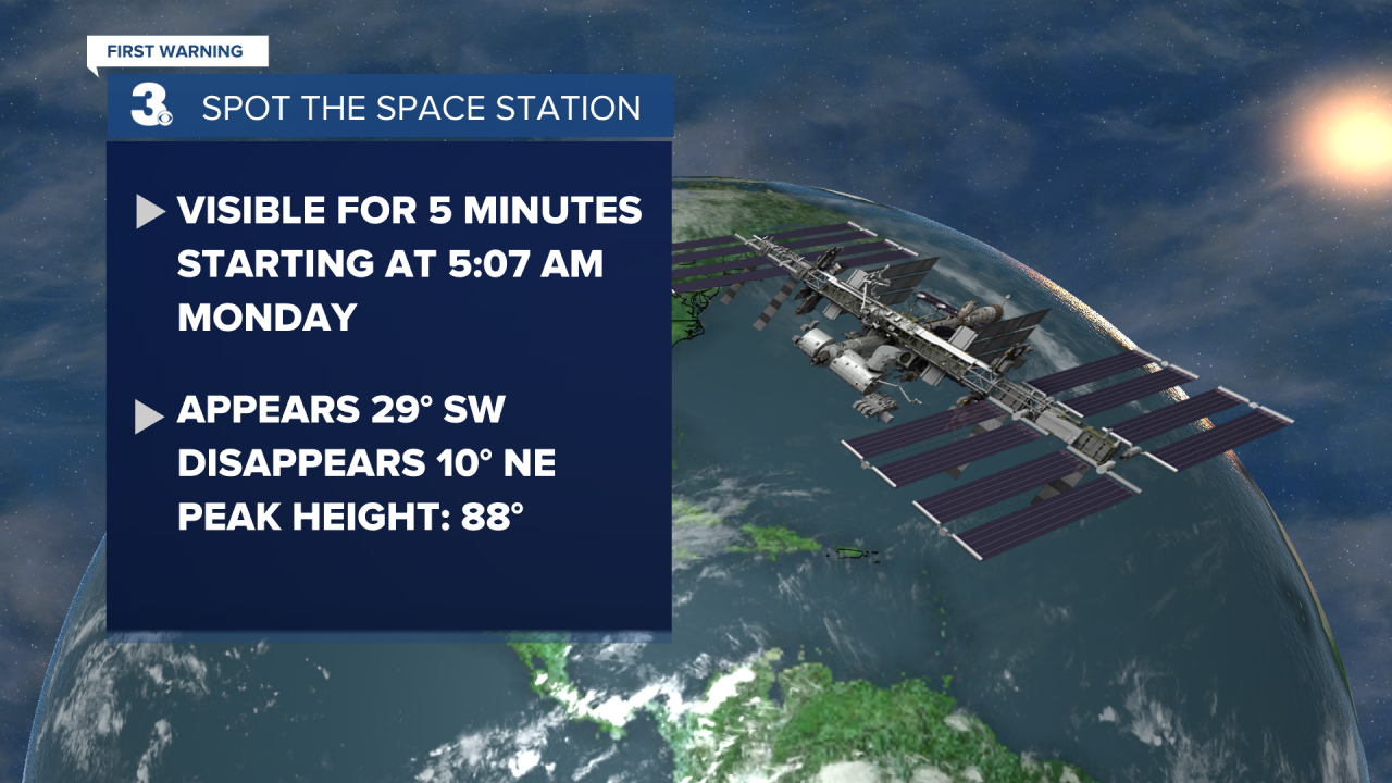
Tonight we stay warm and dry. A mostly clear sky will help temperatures cool down to the low 60s overnight. If you want to catch a good view of the International Space Station, set your alarms for 5:07 AM Monday and look straight up! We’ll have a great view of it with a peak height of 88°. It will appear 29° in the southwest sky and disappear 10° in the northeast sky. The ISS will be visible for 5 minutes.
Early Monday morning, patchy fog could form along the coast. Otherwise, it will be a dry day with a mix of sun and clouds. Highs in the upper 70s along the coast and mid to upper 80s inland.
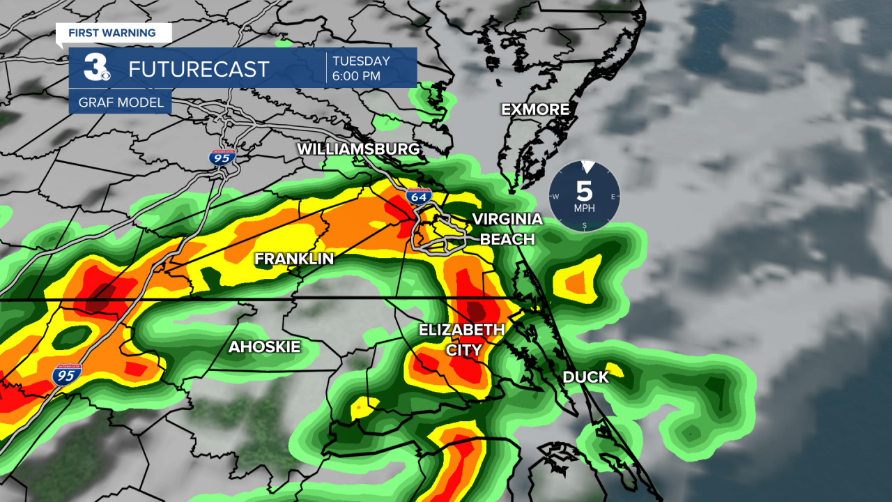
Tuesday is when our weather pattern starts to shift. Highs will still be in the mid 80s, but we will become breezier and cloudier throughout the morning as a cold front approaches. Expect scattered storms throughout the afternoon and evening, mainly 2-10 PM Tuesday. That means a rough and slower commute home could be in store. Scattered lighter rain showers continue throughout Tuesday night into very early Wednesday morning.
We stay breezy behind the front as high pressure starts to work its way in, but we also get much cooler. Highs Wednesday into next weekend will be in the mid 60s with overnight lows dropping into the mid 40s. Lots of sunshine and dry conditions for the second half of the week.
A warm front Sunday looks to bring us a lot of cloud cover, a bump in temps to around 70°, and some isolated to scattered rain showers.
Connect with Meteorologist Kristy Steward:
