


Meteorologist Kristy Steward's First Warning Forecast
Happy Friday night! Today was a couple degrees warmer than yesterday, but still below-average with highs in the mid to upper 60s. This weekend we continue warming up and rain showers start moving in.
Tonight we stay dry and cool. Overnight lows in the mid 40s. Clouds will increase as a warm front inches closer to us.
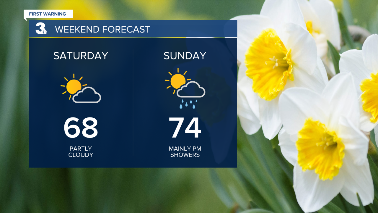
Partly cloudy Saturday and Sunday. Drier Saturday than Sunday. A few isolated showers may enter our inland communities Saturday afternoon, but most areas will stay dry. High temperatures Saturday will be in the upper 60s. Sunday will be the warmer day this weekend as a warm front passes through. Expect seasonable high temperatures in the mid 70s. That warm front kicks off our unsettled off-and-on scattered rain shower pattern. Scattered showers mainly Sunday afternoon and evening, then another round Sunday night into earlier Monday morning.
A few more rounds of showers Tuesday and scattered storms Wednesday ahead of a cold front. That front then stalls to our south, bringing us a mostly dry Thursday, but scattered storms again on Friday.

Temperatures will be above-average most of next week while we’re in this unsettled pattern. Highs in the low 80s Monday, upper 70s Tuesday, mid 80s Wednesday, then stabilizing in the mid 70s Thursday and Friday.
Connect with Meteorologist Kristy Steward:
