


Meteorologist Kristy Steward's First Warning Forecast
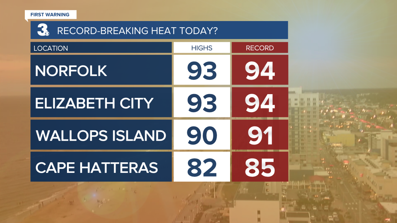
Happy Saturday evening! Today was a scorcher, but it wasn’t record-breaking heat. We were just one degree shy from tying records in many locations. Soon a cold front will pass through and cool us down.
Storms this evening will clear out by 11 PM. Then we stay with a lot of cloud cover overnight. Temperatures remain warm, only dropping into the low 70s.
Tomorrow will still be hot with highs around 90°. We will have a decent breeze with 10-20 MPH southwest winds. Partly cloudy with storms later in the day, likely after 7 PM. We are all under a Level 1 threat for severe storms. Main threats are damaging wind gusts and hail.

A cold front moves through Monday morning, cooling us down to highs in the low 70s and bringing us scattered showers throughout the day. We stay cool and with scattered showers Tuesday. That cold front will briefly stall to our south, then lift north again over Hampton Roads as a warm front Wednesday afternoon/evening.
The warm front will warm us up to the mid 70s Wednesday and mid 80s Thursday. Both Wednesday and Thursday will feature isolated storms.
Another cold front late Friday into early Saturday brings scattered storms Friday and isolated showers Saturday. Highs will become a little cooler and more seasonable in the low 80s and upper 70s.
Connect with Meteorologist Kristy Steward:
