


Meteorologist April Loveland's First Warning Forecast
What a difference a day makes!
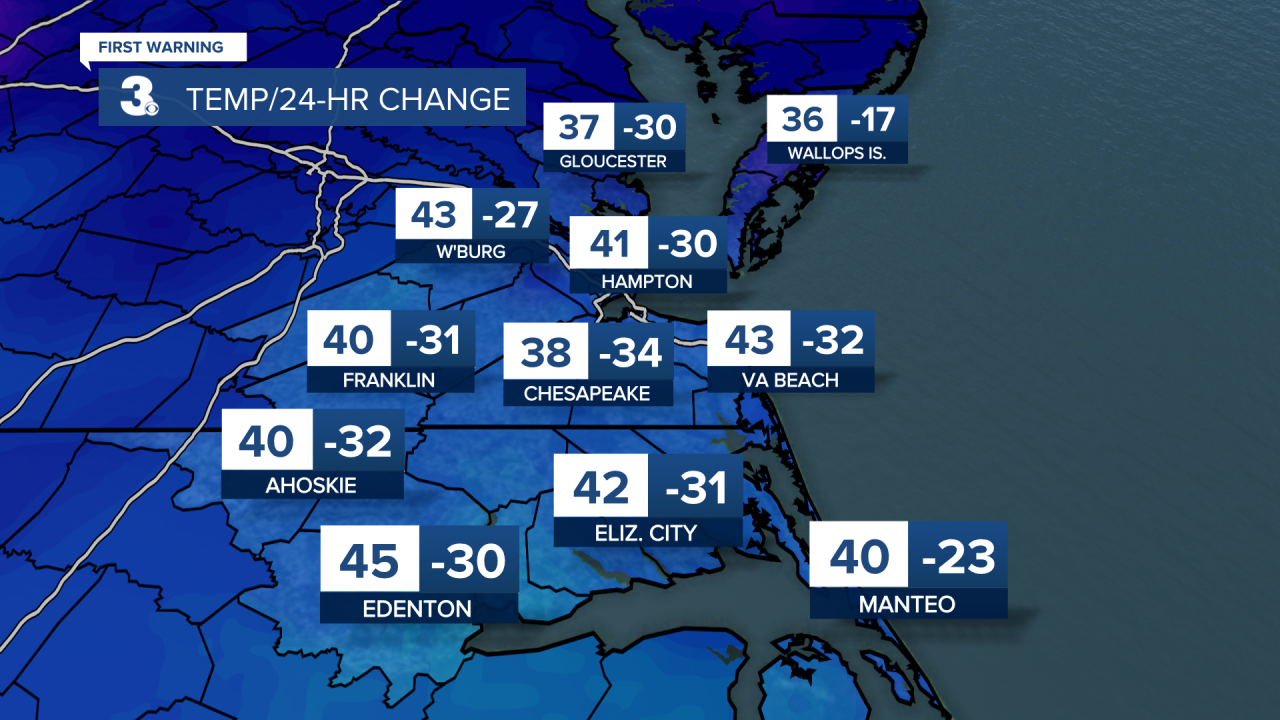
Many areas are 30+ degrees colder than yesterday. Expect highs in the upper 30s and low 40s. It will also be a bit on the breezy side with winds out of the north at 15-20 mph, with higher gusts. Skies will be mostly clear overnight. It will be frigid with lows in the mid 20s.
Sunshine to kick off the day Sunday with clouds building in as the day progresses. Temperatures will warm to the low 40s.
Temperatures will continue to gradually warm as the week progresses. The normal high in Norfolk is now 52 degrees.
Our next weather maker moves in on Monday bringing the chance for rain by the afternoon and evening. Showers will continue overnight and into the morning hours on Tuesday. Highs both days will be in the mid and upper 40s.
Expect dry conditions, sunshine and highs in the 50s Wednesday, Thursday and Friday. Temperatures will make it close to the 60 degree mark by Friday.
Meteorologist April Loveland
For weather updates on Facebook: HERE
Follow me on Twitter: HERE
Follow me on Instagram HERE
Check out the Interactive Radar on WTKR.com: Interactive Radar
