


Meteorologist April Loveland's First Warning Forecast
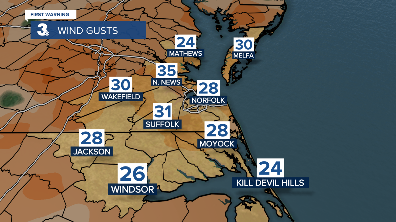
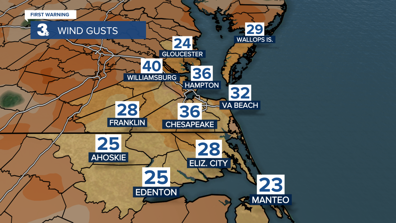
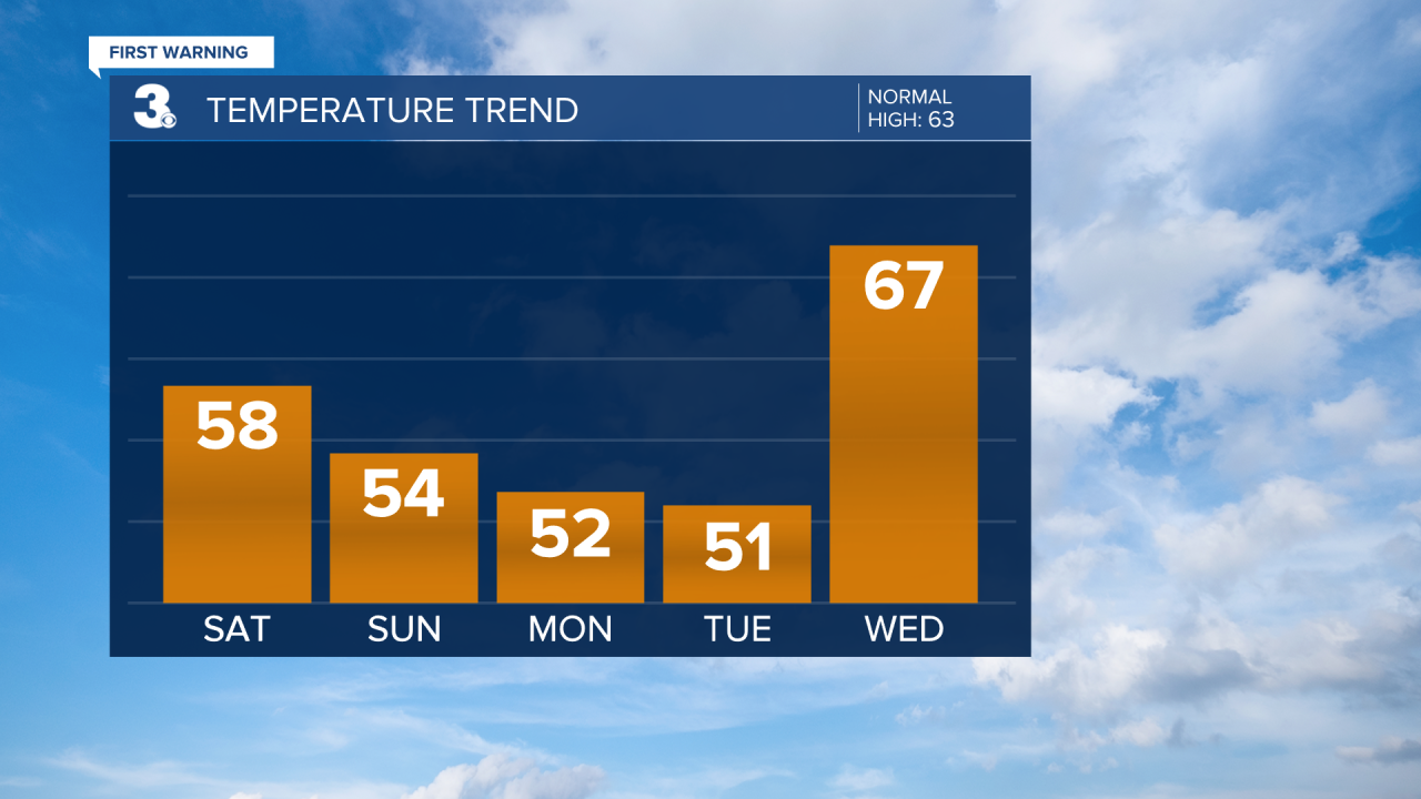
Expect increasing clouds as the day progresses. A cold front will move through, but there isn't much moisture associated with it. Keeping a slight 20 percent chance for a spotty shower. Otherwise, we'll just see more cloud cover. Get ready for the wind! Winds will kick up out of the west at 15 to 25 with gusts 35-40 mph. There is an increased fire danger for northeastern North Carolina due to the wind and low humidity levels. It will also be on the cool side with highs in the upper 50s, with a few low 60s.
Highs will only reach the low and mid 50s on Sunday. We will see a nice mix of sun and clouds, but it will still be windy with NW winds at 10 to 20 and gusts to 30 mph.
Sunday night and Monday morning gets cold! Lows drop to the low to mid 30s, feeling like the mid 20s. Highs in the low 50s, but lots of sunshine to kick off the workweek.
Temperatures jump back up to the mid 60s Wednesday and into the 70s the second half of the workweek. The trade-off for warmer temperatures will be scattered showers on Thursday and morning showers on Friday.
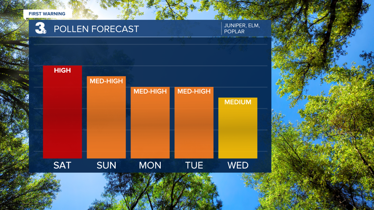
Check out your Pollen Forecast:
Meteorologist April Loveland
For weather updates on Facebook: HERE
Follow me on Twitter: HERE
Follow me on Instagram HERE
Check out the Interactive Radar on WTKR.com: Interactive Radar
