


Meteorologist April Loveland's First Warning Forecast
A coastal storm will impact the area over the next few days. This system will bring rain, wind, coastal and tidal flooding.
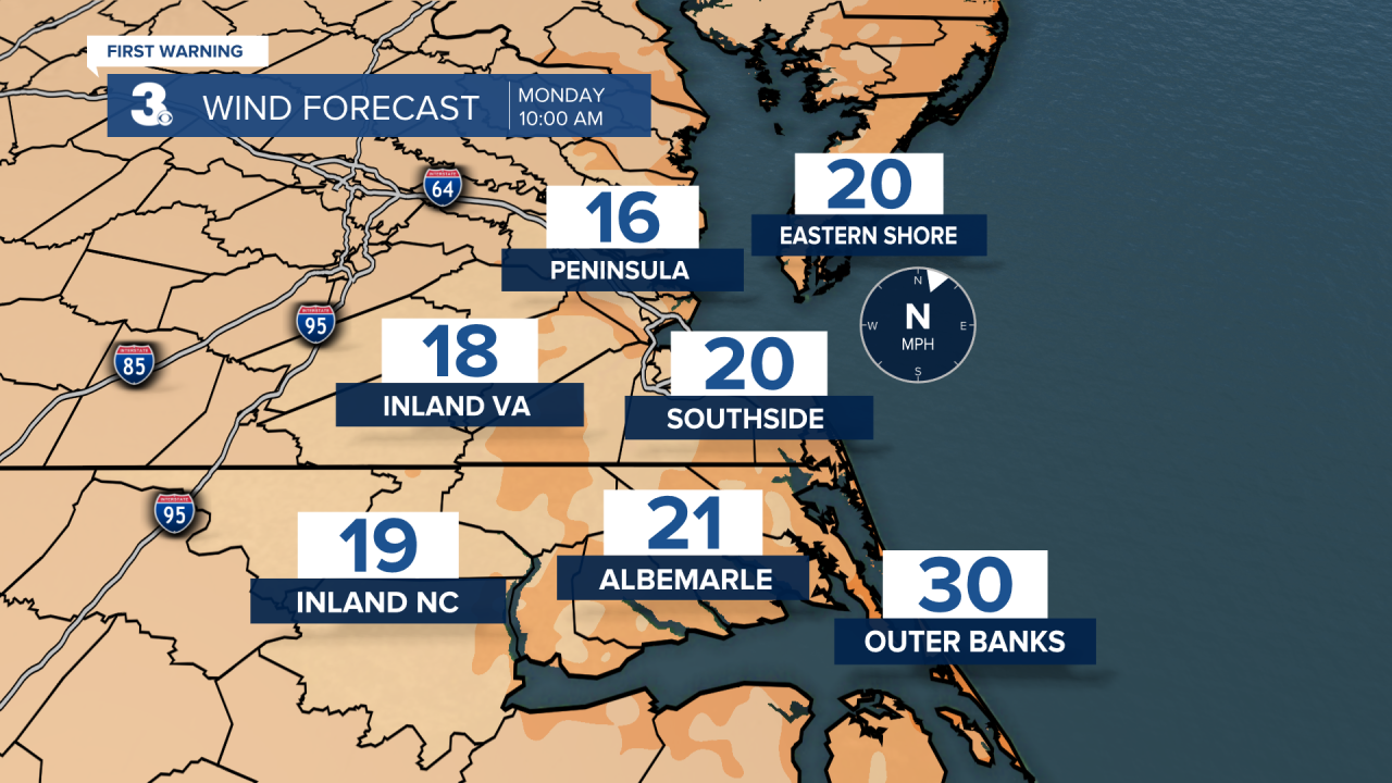
Winds will crank up out of the north for Mother's Day. Expect winds 20-25 mph, with gusts up to 40 mph possible.

Mist, drizzle, and fog with continue throughout the day. Grab the rain gear if you still want to get outside with Mom!

Tidal and coastal flooding will be an issue. Expect moderate tidal flooding at times of high tide through Tuesday. Check out the tide time below at Sewells Point.
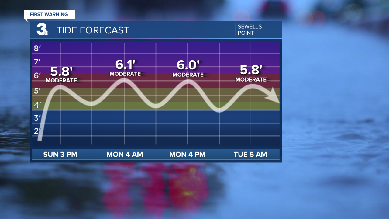
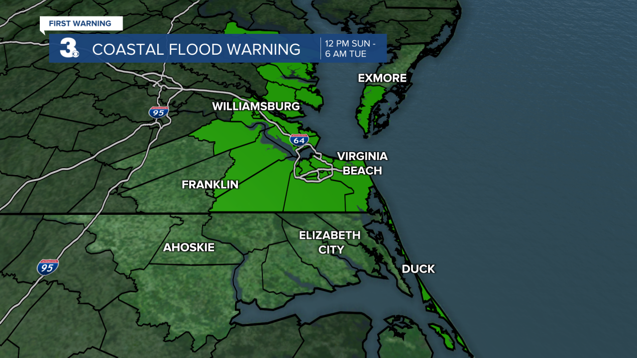
A Coastal Flood Warning is in effect until 12 PM Tuesday.
Temperatures will take a tumble. Highs will struggle to get out of the low 50s, which is well-below normal for this time of year.
Windy and cool to kick off the work week. Winds could gusts up to 35 mph. It will be chilly with highs in the upper 50s. A few spotty showers will be possible.
Pretty much the same story on Tuesday, but temperatures will be a few degrees milder with highs in the low 60s.
Warming to the mid 60s by midweek with a few spotty showers possible.
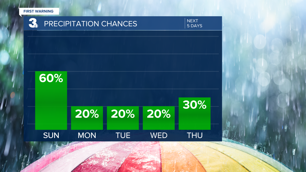
Shower chances will increase by Thursday and Friday, but temperatures will trend a bit warmer. highs will be near 70 on Thursday and to the mid 70s by Friday.
Meteorologist April Loveland
For weather updates on Facebook: HERE
Follow me on Twitter: HERE
Follow me on Instagram HERE
Check out the Interactive Radar on WTKR.com: Interactive Radar
