


Meteorologist Tony Nargi's First Warning Forecast
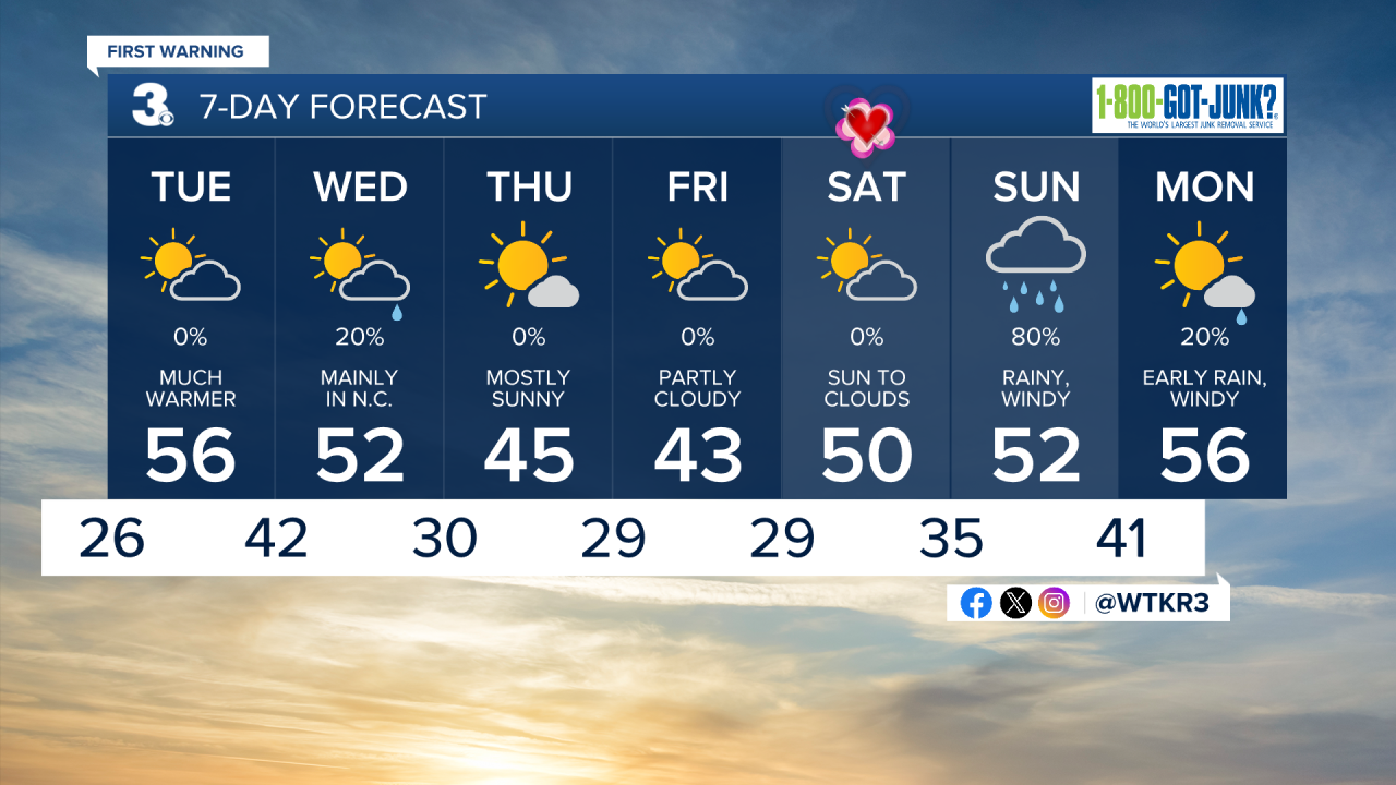
Clear skies are expected this evening along with calm winds. Temperatures will drop down into the upper 20s overnight, with some passing clouds possible after midnight.

Tomorrow will be a great day, with temperatures reaching the mid to upper 50s by the afternoon. We'll see a mix of sunshine and clouds in the morning followed by mostly clear skies during the afternoon. Winds will be light out of the S at 5-10 mph. Overnight some clouds will fill in, with low temperatures only dropping into the upper 30s to low 40s.

Wednesday will start off cloudy with a couple of stray showers possible, mainly on the Outer Banks as a cold front moves through. The chance of rain is only 20%, most towns will stay dry. High temperatures will reach the upper 40s to low 50s, with winds out of the NW at 10-15 mph. Thursday will be cooler, with mainly sunny skies along with high temperatures in the mid 40s. Winds will be out of the NW at 5-15 mph.


Valentines Day will be nice, with high temperatures around 50 along with sunny skies to start followed some clouds filling in. A potent storm will bring lots of rain (no snow thankfully!) and wind to the region on Sunday.
Weather updates on social media:
